You are here: Home > Network List > US - United States National Seismic Network Stations List
> Station NEW Newport, Washington, USA > Earthquake Result Viewer
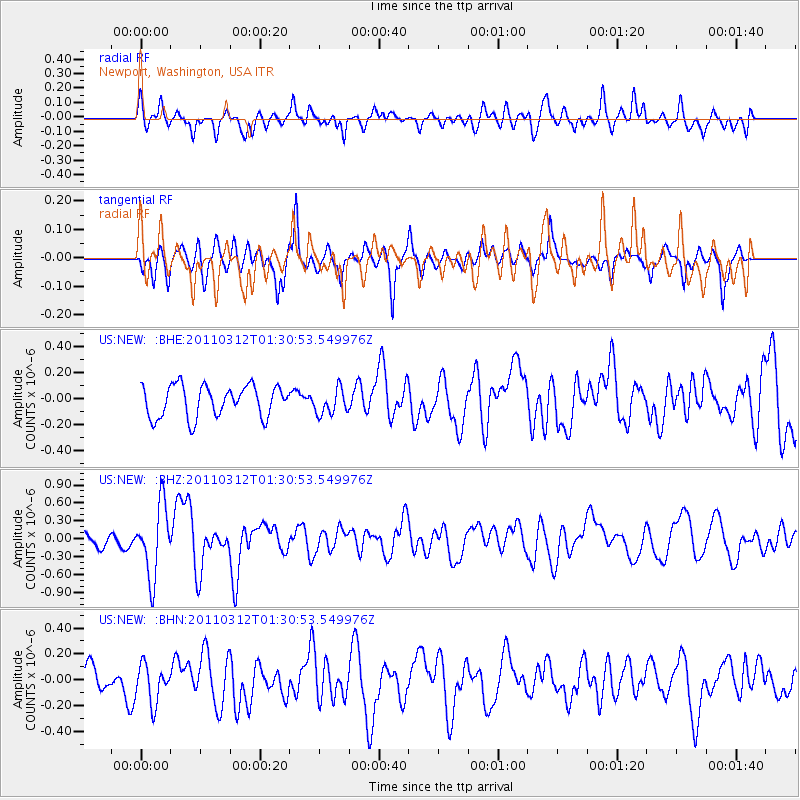
NEW Newport, Washington, USA - Earthquake Result Viewer
*The percent match for this event was below the threshold and hence no stack was calculated.
| Earthquake location: |
Tonga Islands |
| Earthquake latitude/longitude: |
-16.7/-173.2 |
| Earthquake time(UTC): |
2011/03/12 (071) 01:19:07 GMT |
| Earthquake Depth: |
14 km |
| Earthquake Magnitude: |
5.7 MB, 6.0 MS, 5.8 MW |
| Earthquake Catalog/Contributor: |
WHDF/NEIC |
|
| Network: |
US United States National Seismic Network |
| Station: |
NEW Newport, Washington, USA |
| Lat/Lon: |
48.26 N/117.12 W |
| Elevation: |
760 m |
|
| Distance: |
81.7 deg |
| Az: |
34.083 deg |
| Baz: |
233.479 deg |
| Ray Param: |
$rayparam |
*The percent match for this event was below the threshold and hence was not used in the summary stack. |
|
| Radial Match: |
71.479385 % |
| Radial Bump: |
400 |
| Transverse Match: |
59.15535 % |
| Transverse Bump: |
400 |
| SOD ConfigId: |
356183 |
| Insert Time: |
2011-08-19 03:01:29.098 +0000 |
| GWidth: |
2.5 |
| Max Bumps: |
400 |
| Tol: |
0.001 |
|
Signal To Noise
| Channel | StoN | STA | LTA |
| US:NEW: :BHZ:20110312T01:30:53.549976Z | 3.2114666 | 5.9524604E-7 | 1.8535022E-7 |
| US:NEW: :BHN:20110312T01:30:53.549976Z | 1.0575193 | 1.4934665E-7 | 1.4122358E-7 |
| US:NEW: :BHE:20110312T01:30:53.549976Z | 0.80963635 | 9.861808E-8 | 1.218054E-7 |
| Arrivals |
| Ps | |
| PpPs | |
| PsPs/PpSs | |


