You are here: Home > Network List > US - United States National Seismic Network Stations List
> Station BOZ Bozeman, Montana, USA > Earthquake Result Viewer
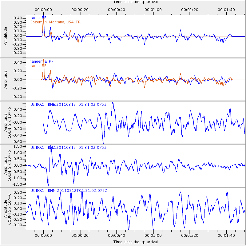
BOZ Bozeman, Montana, USA - Earthquake Result Viewer
*The percent match for this event was below the threshold and hence no stack was calculated.
| Earthquake location: |
Tonga Islands |
| Earthquake latitude/longitude: |
-16.7/-173.2 |
| Earthquake time(UTC): |
2011/03/12 (071) 01:19:07 GMT |
| Earthquake Depth: |
14 km |
| Earthquake Magnitude: |
5.7 MB, 6.0 MS, 5.8 MW |
| Earthquake Catalog/Contributor: |
WHDF/NEIC |
|
| Network: |
US United States National Seismic Network |
| Station: |
BOZ Bozeman, Montana, USA |
| Lat/Lon: |
45.65 N/111.63 W |
| Elevation: |
1589 m |
|
| Distance: |
83.3 deg |
| Az: |
38.397 deg |
| Baz: |
238.044 deg |
| Ray Param: |
$rayparam |
*The percent match for this event was below the threshold and hence was not used in the summary stack. |
|
| Radial Match: |
70.5165 % |
| Radial Bump: |
362 |
| Transverse Match: |
58.793995 % |
| Transverse Bump: |
400 |
| SOD ConfigId: |
356183 |
| Insert Time: |
2011-08-19 03:05:01.773 +0000 |
| GWidth: |
2.5 |
| Max Bumps: |
400 |
| Tol: |
0.001 |
|
Signal To Noise
| Channel | StoN | STA | LTA |
| US:BOZ: :BHZ:20110312T01:31:02.075Z | 6.581223 | 8.3086775E-7 | 1.2624822E-7 |
| US:BOZ: :BHN:20110312T01:31:02.075Z | 1.6908138 | 1.6735633E-7 | 9.8979754E-8 |
| US:BOZ: :BHE:20110312T01:31:02.075Z | 1.7714741 | 3.0341388E-7 | 1.7127762E-7 |
| Arrivals |
| Ps | |
| PpPs | |
| PsPs/PpSs | |


