You are here: Home > Network List > UW - Pacific Northwest Regional Seismic Network Stations List
> Station YACT Amboy, WA, USA > Earthquake Result Viewer
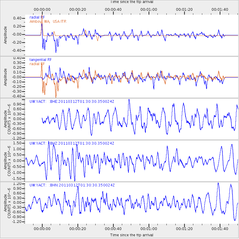
YACT Amboy, WA, USA - Earthquake Result Viewer
*The percent match for this event was below the threshold and hence no stack was calculated.
| Earthquake location: |
Tonga Islands |
| Earthquake latitude/longitude: |
-16.7/-173.2 |
| Earthquake time(UTC): |
2011/03/12 (071) 01:19:07 GMT |
| Earthquake Depth: |
14 km |
| Earthquake Magnitude: |
5.7 MB, 6.0 MS, 5.8 MW |
| Earthquake Catalog/Contributor: |
WHDF/NEIC |
|
| Network: |
UW Pacific Northwest Regional Seismic Network |
| Station: |
YACT Amboy, WA, USA |
| Lat/Lon: |
45.93 N/122.42 W |
| Elevation: |
211 m |
|
| Distance: |
77.4 deg |
| Az: |
33.646 deg |
| Baz: |
229.528 deg |
| Ray Param: |
$rayparam |
*The percent match for this event was below the threshold and hence was not used in the summary stack. |
|
| Radial Match: |
53.959118 % |
| Radial Bump: |
363 |
| Transverse Match: |
53.083378 % |
| Transverse Bump: |
303 |
| SOD ConfigId: |
356183 |
| Insert Time: |
2011-08-19 03:10:50.143 +0000 |
| GWidth: |
2.5 |
| Max Bumps: |
400 |
| Tol: |
0.001 |
|
Signal To Noise
| Channel | StoN | STA | LTA |
| UW:YACT: :BHZ:20110312T01:30:30.350024Z | 2.7172885 | 8.1258526E-7 | 2.9904268E-7 |
| UW:YACT: :BHN:20110312T01:30:30.350024Z | 0.7853087 | 3.0770067E-7 | 3.9182132E-7 |
| UW:YACT: :BHE:20110312T01:30:30.350024Z | 0.7864192 | 2.4818434E-7 | 3.1558784E-7 |
| Arrivals |
| Ps | |
| PpPs | |
| PsPs/PpSs | |


