You are here: Home > Network List > TA - USArray Transportable Network (new EarthScope stations) Stations List
> Station T25A Trinidad, CO, USA > Earthquake Result Viewer
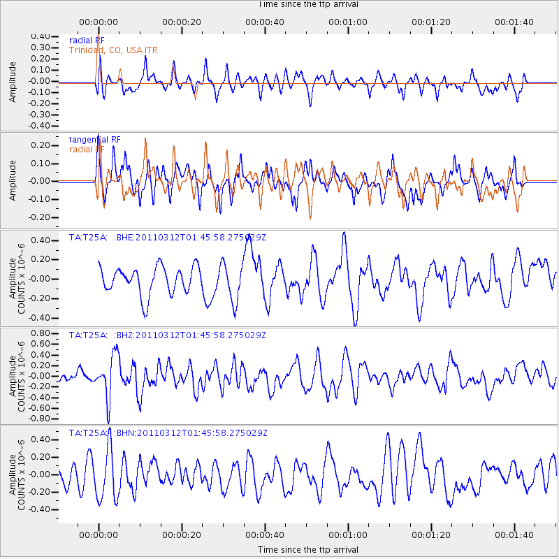
T25A Trinidad, CO, USA - Earthquake Result Viewer
*The percent match for this event was below the threshold and hence no stack was calculated.
| Earthquake location: |
Near East Coast Of Honshu, Japan |
| Earthquake latitude/longitude: |
38.8/142.8 |
| Earthquake time(UTC): |
2011/03/12 (071) 01:34:09 GMT |
| Earthquake Depth: |
22 km |
| Earthquake Magnitude: |
5.6 MB, 5.9 MS |
| Earthquake Catalog/Contributor: |
WHDF/NEIC |
|
| Network: |
TA USArray Transportable Network (new EarthScope stations) |
| Station: |
T25A Trinidad, CO, USA |
| Lat/Lon: |
37.14 N/104.41 W |
| Elevation: |
2017 m |
|
| Distance: |
82.4 deg |
| Az: |
48.032 deg |
| Baz: |
313.322 deg |
| Ray Param: |
$rayparam |
*The percent match for this event was below the threshold and hence was not used in the summary stack. |
|
| Radial Match: |
44.800373 % |
| Radial Bump: |
380 |
| Transverse Match: |
52.278088 % |
| Transverse Bump: |
314 |
| SOD ConfigId: |
356183 |
| Insert Time: |
2011-08-19 04:06:26.840 +0000 |
| GWidth: |
2.5 |
| Max Bumps: |
400 |
| Tol: |
0.001 |
|
Signal To Noise
| Channel | StoN | STA | LTA |
| TA:T25A: :BHZ:20110312T01:45:58.275029Z | 3.8537056 | 4.0971193E-7 | 1.0631636E-7 |
| TA:T25A: :BHN:20110312T01:45:58.275029Z | 3.0624762 | 2.9877967E-7 | 9.756147E-8 |
| TA:T25A: :BHE:20110312T01:45:58.275029Z | 1.4192473 | 1.9774617E-7 | 1.3933172E-7 |
| Arrivals |
| Ps | |
| PpPs | |
| PsPs/PpSs | |


