You are here: Home > Network List > TA - USArray Transportable Network (new EarthScope stations) Stations List
> Station H27A Howes, SD, USA > Earthquake Result Viewer
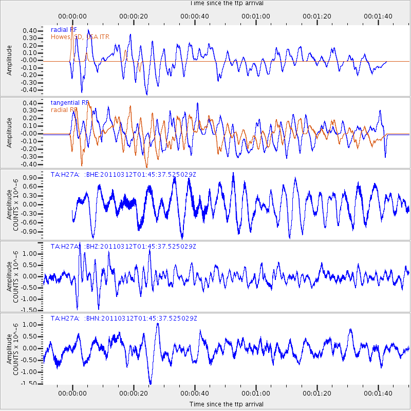
H27A Howes, SD, USA - Earthquake Result Viewer
*The percent match for this event was below the threshold and hence no stack was calculated.
| Earthquake location: |
Near East Coast Of Honshu, Japan |
| Earthquake latitude/longitude: |
38.8/142.8 |
| Earthquake time(UTC): |
2011/03/12 (071) 01:34:09 GMT |
| Earthquake Depth: |
22 km |
| Earthquake Magnitude: |
5.6 MB, 5.9 MS |
| Earthquake Catalog/Contributor: |
WHDF/NEIC |
|
| Network: |
TA USArray Transportable Network (new EarthScope stations) |
| Station: |
H27A Howes, SD, USA |
| Lat/Lon: |
44.63 N/102.08 W |
| Elevation: |
748 m |
|
| Distance: |
78.5 deg |
| Az: |
41.292 deg |
| Baz: |
313.723 deg |
| Ray Param: |
$rayparam |
*The percent match for this event was below the threshold and hence was not used in the summary stack. |
|
| Radial Match: |
66.856384 % |
| Radial Bump: |
400 |
| Transverse Match: |
64.762215 % |
| Transverse Bump: |
400 |
| SOD ConfigId: |
356183 |
| Insert Time: |
2011-08-19 04:15:51.807 +0000 |
| GWidth: |
2.5 |
| Max Bumps: |
400 |
| Tol: |
0.001 |
|
Signal To Noise
| Channel | StoN | STA | LTA |
| TA:H27A: :BHZ:20110312T01:45:37.525029Z | 3.332756 | 6.91712E-7 | 2.0754953E-7 |
| TA:H27A: :BHN:20110312T01:45:37.525029Z | 1.2138802 | 3.9436011E-7 | 3.2487563E-7 |
| TA:H27A: :BHE:20110312T01:45:37.525029Z | 1.1558001 | 4.4047513E-7 | 3.8109974E-7 |
| Arrivals |
| Ps | |
| PpPs | |
| PsPs/PpSs | |


