You are here: Home > Network List > TA - USArray Transportable Network (new EarthScope stations) Stations List
> Station D30A Buchanan, ND, USA > Earthquake Result Viewer
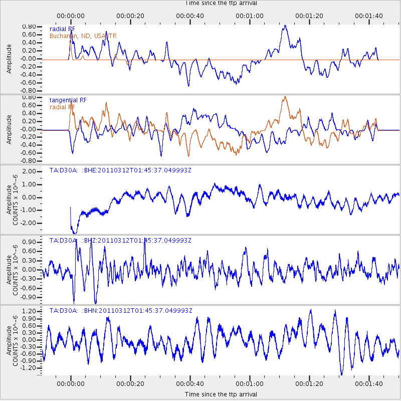
D30A Buchanan, ND, USA - Earthquake Result Viewer
*The percent match for this event was below the threshold and hence no stack was calculated.
| Earthquake location: |
Near East Coast Of Honshu, Japan |
| Earthquake latitude/longitude: |
38.8/142.8 |
| Earthquake time(UTC): |
2011/03/12 (071) 01:34:09 GMT |
| Earthquake Depth: |
22 km |
| Earthquake Magnitude: |
5.6 MB, 5.9 MS |
| Earthquake Catalog/Contributor: |
WHDF/NEIC |
|
| Network: |
TA USArray Transportable Network (new EarthScope stations) |
| Station: |
D30A Buchanan, ND, USA |
| Lat/Lon: |
47.11 N/98.76 W |
| Elevation: |
465 m |
|
| Distance: |
78.4 deg |
| Az: |
37.831 deg |
| Baz: |
315.405 deg |
| Ray Param: |
$rayparam |
*The percent match for this event was below the threshold and hence was not used in the summary stack. |
|
| Radial Match: |
36.463753 % |
| Radial Bump: |
400 |
| Transverse Match: |
40.262287 % |
| Transverse Bump: |
400 |
| SOD ConfigId: |
356183 |
| Insert Time: |
2011-08-19 04:20:05.258 +0000 |
| GWidth: |
2.5 |
| Max Bumps: |
400 |
| Tol: |
0.001 |
|
Signal To Noise
| Channel | StoN | STA | LTA |
| TA:D30A: :BHZ:20110312T01:45:37.049993Z | 3.4774466 | 5.1785497E-7 | 1.4891818E-7 |
| TA:D30A: :BHN:20110312T01:45:37.049993Z | 0.5294207 | 3.2539143E-7 | 6.1461793E-7 |
| TA:D30A: :BHE:20110312T01:45:37.049993Z | 1.1171316 | 9.831072E-7 | 8.800281E-7 |
| Arrivals |
| Ps | |
| PpPs | |
| PsPs/PpSs | |


