You are here: Home > Network List > TA - USArray Transportable Network (new EarthScope stations) Stations List
> Station C36A Pine Crest Fram, Angora, MN, USA > Earthquake Result Viewer
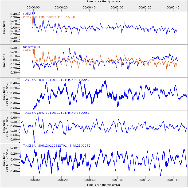
C36A Pine Crest Fram, Angora, MN, USA - Earthquake Result Viewer
*The percent match for this event was below the threshold and hence no stack was calculated.
| Earthquake location: |
Near East Coast Of Honshu, Japan |
| Earthquake latitude/longitude: |
38.8/142.8 |
| Earthquake time(UTC): |
2011/03/12 (071) 01:34:09 GMT |
| Earthquake Depth: |
22 km |
| Earthquake Magnitude: |
5.6 MB, 5.9 MS |
| Earthquake Catalog/Contributor: |
WHDF/NEIC |
|
| Network: |
TA USArray Transportable Network (new EarthScope stations) |
| Station: |
C36A Pine Crest Fram, Angora, MN, USA |
| Lat/Lon: |
47.76 N/92.84 W |
| Elevation: |
410 m |
|
| Distance: |
80.6 deg |
| Az: |
34.381 deg |
| Baz: |
319.125 deg |
| Ray Param: |
$rayparam |
*The percent match for this event was below the threshold and hence was not used in the summary stack. |
|
| Radial Match: |
55.38583 % |
| Radial Bump: |
400 |
| Transverse Match: |
39.180195 % |
| Transverse Bump: |
400 |
| SOD ConfigId: |
356183 |
| Insert Time: |
2011-08-19 04:51:28.590 +0000 |
| GWidth: |
2.5 |
| Max Bumps: |
400 |
| Tol: |
0.001 |
|
Signal To Noise
| Channel | StoN | STA | LTA |
| TA:C36A: :BHZ:20110312T01:45:49.250005Z | 3.331434 | 5.5927035E-7 | 1.6787676E-7 |
| TA:C36A: :BHN:20110312T01:45:49.250005Z | 1.2934011 | 2.3133396E-7 | 1.7885709E-7 |
| TA:C36A: :BHE:20110312T01:45:49.250005Z | 1.1813413 | 3.0036952E-7 | 2.5426144E-7 |
| Arrivals |
| Ps | |
| PpPs | |
| PsPs/PpSs | |


