RDM AZ.RDM - Earthquake Result Viewer
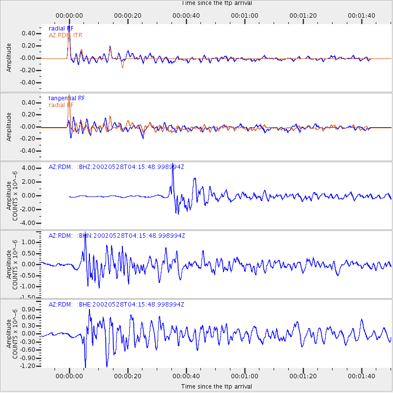
Earthquake location: Catamarca Province, Argentina
Earthquake latitude/longitude: -28.9/-66.8
Earthquake time(UTC): 2002/05/28 (148) 04:04:22 GMT
Earthquake Depth: 22 km
Earthquake Magnitude: 6.0 MB, 5.7 MS, 6.0 MW, 5.9 MW
Earthquake Catalog/Contributor: WHDF/NEIC
Network: AZ ANZA Regional Network
Station: RDM AZ.RDM
Lat/Lon: 33.63 N/116.85 W
Elevation: 1365 m
Distance: 78.2 deg
Az: 319.202 deg
Baz: 136.652 deg
Ray Param: 0.049770035
Estimated Moho Depth: 33.0 km
Estimated Crust Vp/Vs: 1.75
Assumed Crust Vp: 6.264 km/s
Estimated Crust Vs: 3.579 km/s
Estimated Crust Poisson's Ratio: 0.26
Radial Match: 94.56124 %
Radial Bump: 400
Transverse Match: 88.06695 %
Transverse Bump: 400
SOD ConfigId: 32974
Insert Time: 2010-02-26 20:26:15.929 +0000
GWidth: 2.5
Max Bumps: 400
Tol: 0.001

Signal To Noise

ChannelStoNSTALTA
AZ:RDM: :BHN:20020528T04:15:48.998994Z2.88671681.9924518E-76.9021375E-8
AZ:RDM: :BHE:20020528T04:15:48.998994Z1.27765151.12730774E-78.8232795E-8
AZ:RDM: :BHZ:20020528T04:15:48.998994Z5.27632864.0323226E-77.642289E-8
Arrivals
Ps4.1 SECOND
PpPs14 SECOND
PsPs/PpSs18 SECOND