RDM AZ.RDM - Earthquake Result Viewer
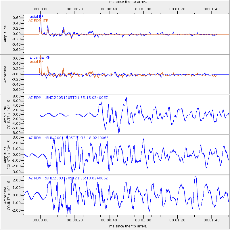
Earthquake location: Komandorskiye Ostrova Region
Earthquake latitude/longitude: 55.5/165.8
Earthquake time(UTC): 2003/12/05 (339) 21:26:09 GMT
Earthquake Depth: 10 km
Earthquake Magnitude: 6.1 MB, 6.5 MS, 6.7 MW, 6.7 MW
Earthquake Catalog/Contributor: WHDF/NEIC
Network: AZ ANZA Regional Network
Station: RDM AZ.RDM
Lat/Lon: 33.63 N/116.85 W
Elevation: 1365 m
Distance: 56.1 deg
Az: 78.659 deg
Baz: 318.087 deg
Ray Param: 0.064338036
Estimated Moho Depth: 33.25 km
Estimated Crust Vp/Vs: 1.79
Assumed Crust Vp: 6.264 km/s
Estimated Crust Vs: 3.499 km/s
Estimated Crust Poisson's Ratio: 0.27
Radial Match: 95.68178 %
Radial Bump: 325
Transverse Match: 88.28457 %
Transverse Bump: 400
SOD ConfigId: 32974
Insert Time: 2010-02-26 20:26:34.502 +0000
GWidth: 2.5
Max Bumps: 400
Tol: 0.001

Signal To Noise

ChannelStoNSTALTA
AZ:RDM: :BHN:20031205T21:35:18.024006Z3.90316758.517751E-72.1822663E-7
AZ:RDM: :BHE:20031205T21:35:18.024006Z1.61151136.740042E-74.1824353E-7
AZ:RDM: :BHZ:20031205T21:35:18.024006Z4.3191831.8251186E-64.2256107E-7
Arrivals
Ps4.4 SECOND
PpPs14 SECOND
PsPs/PpSs19 SECOND