FRB Iqaluit, Nunavut Territory, Canada - Earthquake Result Viewer
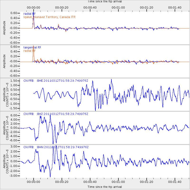
Earthquake location: Off East Coast Of Honshu, Japan
Earthquake latitude/longitude: 37.6/142.6
Earthquake time(UTC): 2011/03/12 (071) 01:47:15 GMT
Earthquake Depth: 20 km
Earthquake Magnitude: 6.2 MB, 6.4 MS, 6.5 MW, 6.5 MW
Earthquake Catalog/Contributor: WHDF/NEIC
Network: CN Canadian National Seismograph Network
Station: FRB Iqaluit, Nunavut Territory, Canada
Lat/Lon: 63.75 N/68.55 W
Elevation: 25 m
Distance: 76.0 deg
Az: 13.732 deg
Baz: 334.913 deg
Ray Param: 0.05127005
Estimated Moho Depth: 42.5 km
Estimated Crust Vp/Vs: 1.76
Assumed Crust Vp: 6.419 km/s
Estimated Crust Vs: 3.637 km/s
Estimated Crust Poisson's Ratio: 0.26
Radial Match: 94.22051 %
Radial Bump: 385
Transverse Match: 71.819916 %
Transverse Bump: 400
SOD ConfigId: 356183
Insert Time: 2011-08-19 07:06:54.058 +0000
GWidth: 2.5
Max Bumps: 400
Tol: 0.001

Signal To Noise

ChannelStoNSTALTA
CN:FRB: :BHZ:20110312T01:58:29.749976Z23.9916483.5850935E-61.494309E-7
CN:FRB: :BHN:20110312T01:58:29.749976Z7.76395131.483271E-61.910459E-7
CN:FRB: :BHE:20110312T01:58:29.749976Z2.41131937.4982563E-73.1096073E-7
Arrivals
Ps5.2 SECOND
PpPs18 SECOND
PsPs/PpSs23 SECOND