You are here: Home > Network List > IW - Intermountain West Stations List
> Station DLMT Dillon, Montana, USA > Earthquake Result Viewer
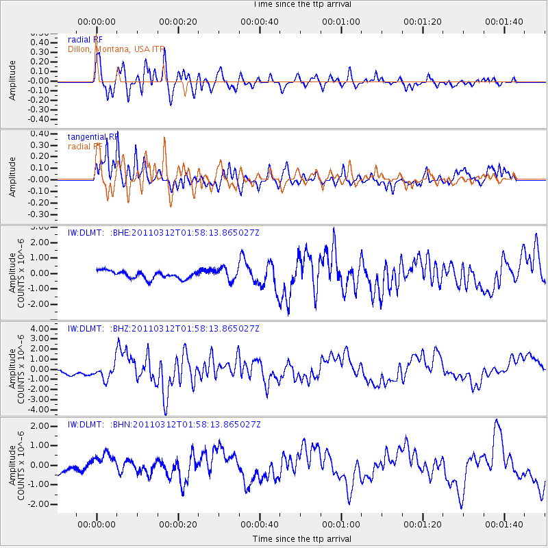
DLMT Dillon, Montana, USA - Earthquake Result Viewer
*The percent match for this event was below the threshold and hence no stack was calculated.
| Earthquake location: |
Off East Coast Of Honshu, Japan |
| Earthquake latitude/longitude: |
37.6/142.6 |
| Earthquake time(UTC): |
2011/03/12 (071) 01:47:15 GMT |
| Earthquake Depth: |
20 km |
| Earthquake Magnitude: |
6.2 MB, 6.4 MS, 6.5 MW, 6.5 MW |
| Earthquake Catalog/Contributor: |
WHDF/NEIC |
|
| Network: |
IW Intermountain West |
| Station: |
DLMT Dillon, Montana, USA |
| Lat/Lon: |
45.36 N/112.60 W |
| Elevation: |
1569 m |
|
| Distance: |
73.2 deg |
| Az: |
45.395 deg |
| Baz: |
306.662 deg |
| Ray Param: |
$rayparam |
*The percent match for this event was below the threshold and hence was not used in the summary stack. |
|
| Radial Match: |
83.74744 % |
| Radial Bump: |
400 |
| Transverse Match: |
83.291794 % |
| Transverse Bump: |
375 |
| SOD ConfigId: |
356183 |
| Insert Time: |
2011-08-19 07:21:39.647 +0000 |
| GWidth: |
2.5 |
| Max Bumps: |
400 |
| Tol: |
0.001 |
|
Signal To Noise
| Channel | StoN | STA | LTA |
| IW:DLMT: :BHZ:20110312T01:58:13.865027Z | 3.4687612 | 8.0425343E-7 | 2.3185609E-7 |
| IW:DLMT: :BHN:20110312T01:58:13.865027Z | 2.1167696 | 5.235082E-7 | 2.473147E-7 |
| IW:DLMT: :BHE:20110312T01:58:13.865027Z | 1.7040519 | 4.1478285E-7 | 2.4340977E-7 |
| Arrivals |
| Ps | |
| PpPs | |
| PsPs/PpSs | |


