
KBK KN.KBK - Earthquake Result Viewer
| ||||||||||||||||||
| ||||||||||||||||||
| ||||||||||||||||||
|
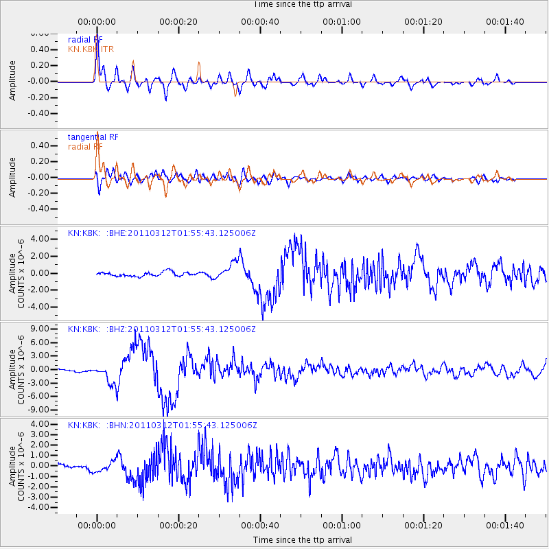
Signal To Noise
| Channel | StoN | STA | LTA |
| KN:KBK: :BHZ:20110312T01:55:43.125006Z | 8.844363 | 2.2100148E-6 | 2.4987835E-7 |
| KN:KBK: :BHN:20110312T01:55:43.125006Z | 1.7505106 | 4.9049055E-7 | 2.8019858E-7 |
| KN:KBK: :BHE:20110312T01:55:43.125006Z | 4.349079 | 1.061896E-6 | 2.441657E-7 |
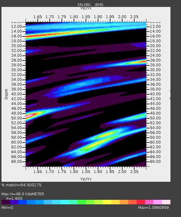
| Arrivals | |
| Ps | 5.0 SECOND |
| PpPs | 19 SECOND |
| PsPs/PpSs | 24 SECOND |

