MDND Maddock, ND, USA - Earthquake Result Viewer
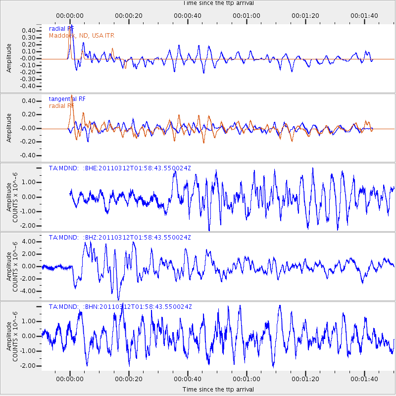
Earthquake location: Off East Coast Of Honshu, Japan
Earthquake latitude/longitude: 37.6/142.6
Earthquake time(UTC): 2011/03/12 (071) 01:47:15 GMT
Earthquake Depth: 20 km
Earthquake Magnitude: 6.2 MB, 6.4 MS, 6.5 MW, 6.5 MW
Earthquake Catalog/Contributor: WHDF/NEIC
Network: TA USArray Transportable Network (new EarthScope stations)
Station: MDND Maddock, ND, USA
Lat/Lon: 47.85 N/99.60 W
Elevation: 479 m
Distance: 78.5 deg
Az: 37.473 deg
Baz: 314.155 deg
Ray Param: 0.049601708
Estimated Moho Depth: 31.0 km
Estimated Crust Vp/Vs: 1.94
Assumed Crust Vp: 6.53 km/s
Estimated Crust Vs: 3.362 km/s
Estimated Crust Poisson's Ratio: 0.32
Radial Match: 82.39438 %
Radial Bump: 400
Transverse Match: 70.46069 %
Transverse Bump: 400
SOD ConfigId: 356183
Insert Time: 2011-08-19 07:42:39.867 +0000
GWidth: 2.5
Max Bumps: 400
Tol: 0.001

Signal To Noise

ChannelStoNSTALTA
TA:MDND: :BHZ:20110312T01:58:43.550024Z8.1720141.7859192E-62.1854089E-7
TA:MDND: :BHN:20110312T01:58:43.550024Z1.3282269.1446043E-76.884826E-7
TA:MDND: :BHE:20110312T01:58:43.550024Z1.64787925.5350546E-73.3588955E-7
Arrivals
Ps4.6 SECOND
PpPs14 SECOND
PsPs/PpSs18 SECOND