T29A Hugoton, KS, USA - Earthquake Result Viewer
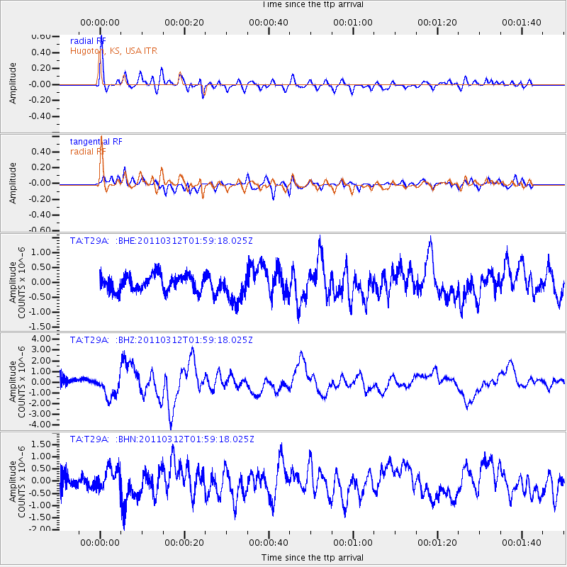
Earthquake location: Off East Coast Of Honshu, Japan
Earthquake latitude/longitude: 37.6/142.6
Earthquake time(UTC): 2011/03/12 (071) 01:47:15 GMT
Earthquake Depth: 20 km
Earthquake Magnitude: 6.2 MB, 6.4 MS, 6.5 MW, 6.5 MW
Earthquake Catalog/Contributor: WHDF/NEIC
Network: TA USArray Transportable Network (new EarthScope stations)
Station: T29A Hugoton, KS, USA
Lat/Lon: 37.16 N/101.29 W
Elevation: 936 m
Distance: 85.0 deg
Az: 46.09 deg
Baz: 314.252 deg
Ray Param: 0.045037746
Estimated Moho Depth: 44.5 km
Estimated Crust Vp/Vs: 1.81
Assumed Crust Vp: 6.483 km/s
Estimated Crust Vs: 3.582 km/s
Estimated Crust Poisson's Ratio: 0.28
Radial Match: 80.76886 %
Radial Bump: 400
Transverse Match: 74.510544 %
Transverse Bump: 400
SOD ConfigId: 356183
Insert Time: 2011-08-19 07:46:29.909 +0000
GWidth: 2.5
Max Bumps: 400
Tol: 0.001

Signal To Noise

ChannelStoNSTALTA
TA:T29A: :BHZ:20110312T01:59:18.025Z3.54637721.0214934E-62.8803856E-7
TA:T29A: :BHN:20110312T01:59:18.025Z1.25777794.532228E-73.6033612E-7
TA:T29A: :BHE:20110312T01:59:18.025Z1.90997525.1031986E-72.6718664E-7
Arrivals
Ps5.7 SECOND
PpPs19 SECOND
PsPs/PpSs25 SECOND