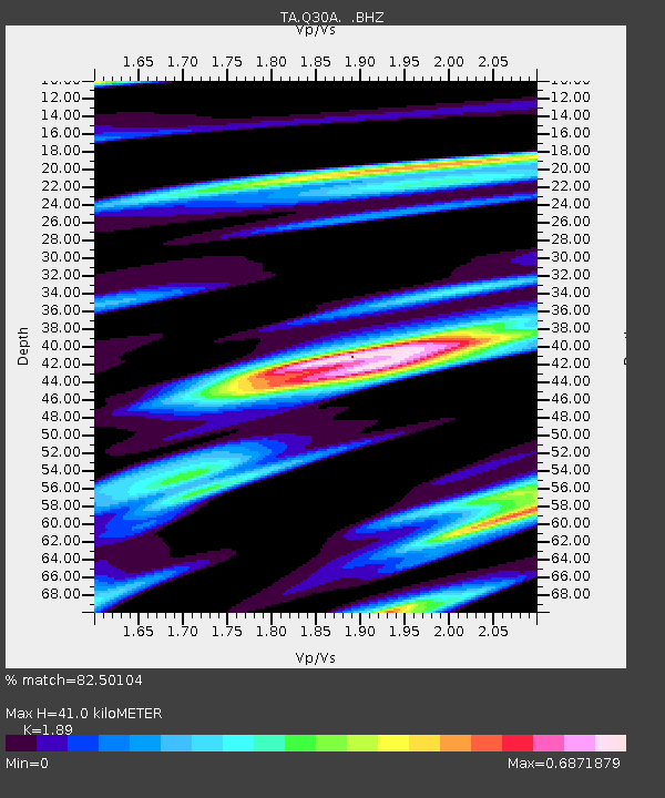
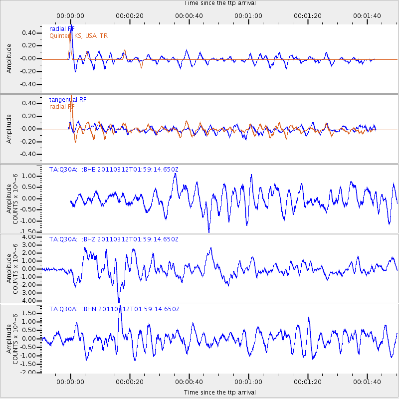
Q30A Quinter, KS, USA - Earthquake Result Viewer

Earthquake location: Off East Coast Of Honshu, Japan
Earthquake latitude/longitude: 37.6/142.6
Earthquake time(UTC): 2011/03/12 (071) 01:47:15 GMT
Earthquake Depth: 20 km
Earthquake Magnitude: 6.2 MB, 6.4 MS, 6.5 MW, 6.5 MW
Earthquake Catalog/Contributor: WHDF/NEIC
Network: TA USArray Transportable Network (new EarthScope stations)
Station: Q30A Quinter, KS, USA
Lat/Lon: 38.98 N/100.22 W
Elevation: 797 m
Distance: 84.4 deg
Az: 44.191 deg
Baz: 314.736 deg
Ray Param: 0.04551891
Estimated Moho Depth: 41.0 km
Estimated Crust Vp/Vs: 1.89
Assumed Crust Vp: 6.483 km/s
Estimated Crust Vs: 3.43 km/s
Estimated Crust Poisson's Ratio: 0.31
Radial Match: 82.50104 %
Radial Bump: 400
Transverse Match: 60.533844 %
Transverse Bump: 400
SOD ConfigId: 356183
Insert Time: 2011-08-19 07:51:40.277 +0000
GWidth: 2.5
Max Bumps: 400
Tol: 0.001

Signal To Noise

ChannelStoNSTALTA
TA:Q30A: :BHZ:20110312T01:59:14.650Z8.0983381.2657429E-61.5629662E-7
TA:Q30A: :BHN:20110312T01:59:14.650Z1.60682454.2118506E-72.6212263E-7
TA:Q30A: :BHE:20110312T01:59:14.650Z2.677444.5177882E-71.6873537E-7
Arrivals
Ps5.8 SECOND
PpPs18 SECOND
PsPs/PpSs24 SECOND