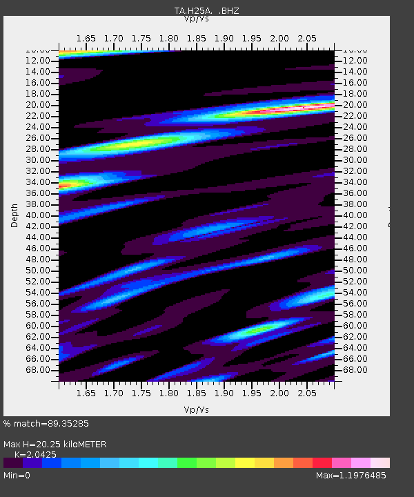
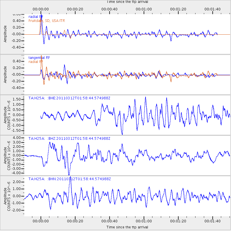
H25A Fruitdale, SD, USA - Earthquake Result Viewer

Earthquake location: Off East Coast Of Honshu, Japan
Earthquake latitude/longitude: 37.6/142.6
Earthquake time(UTC): 2011/03/12 (071) 01:47:15 GMT
Earthquake Depth: 20 km
Earthquake Magnitude: 6.2 MB, 6.4 MS, 6.5 MW, 6.5 MW
Earthquake Catalog/Contributor: WHDF/NEIC
Network: TA USArray Transportable Network (new EarthScope stations)
Station: H25A Fruitdale, SD, USA
Lat/Lon: 44.62 N/103.60 W
Elevation: 942 m
Distance: 78.7 deg
Az: 41.809 deg
Baz: 312.138 deg
Ray Param: 0.049477678
Estimated Moho Depth: 20.25 km
Estimated Crust Vp/Vs: 2.04
Assumed Crust Vp: 6.242 km/s
Estimated Crust Vs: 3.056 km/s
Estimated Crust Poisson's Ratio: 0.34
Radial Match: 89.35285 %
Radial Bump: 400
Transverse Match: 82.192696 %
Transverse Bump: 400
SOD ConfigId: 356183
Insert Time: 2011-08-19 08:01:20.154 +0000
GWidth: 2.5
Max Bumps: 400
Tol: 0.001

Signal To Noise

ChannelStoNSTALTA
TA:H25A: :BHZ:20110312T01:58:44.574988Z11.1141281.3940587E-61.2543123E-7
TA:H25A: :BHN:20110312T01:58:44.574988Z2.1132244.6549536E-72.2027734E-7
TA:H25A: :BHE:20110312T01:58:44.574988Z2.1046524.8309363E-72.295361E-7
Arrivals
Ps3.5 SECOND
PpPs9.6 SECOND
PsPs/PpSs13 SECOND