G29A Hoven, SD, USA - Earthquake Result Viewer
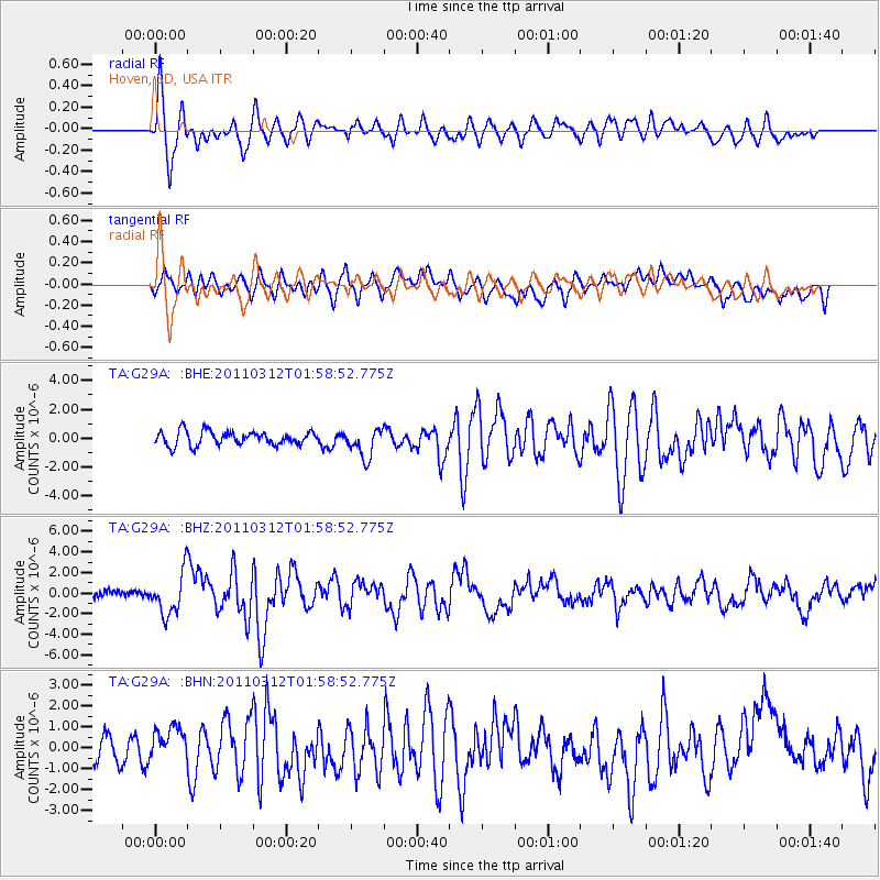
Earthquake location: Off East Coast Of Honshu, Japan
Earthquake latitude/longitude: 37.6/142.6
Earthquake time(UTC): 2011/03/12 (071) 01:47:15 GMT
Earthquake Depth: 20 km
Earthquake Magnitude: 6.2 MB, 6.4 MS, 6.5 MW, 6.5 MW
Earthquake Catalog/Contributor: WHDF/NEIC
Network: TA USArray Transportable Network (new EarthScope stations)
Station: G29A Hoven, SD, USA
Lat/Lon: 45.19 N/99.92 W
Elevation: 588 m
Distance: 80.2 deg
Az: 39.567 deg
Baz: 314.311 deg
Ray Param: 0.048445713
Estimated Moho Depth: 10.5 km
Estimated Crust Vp/Vs: 1.60
Assumed Crust Vp: 6.53 km/s
Estimated Crust Vs: 4.082 km/s
Estimated Crust Poisson's Ratio: 0.18
Radial Match: 81.2296 %
Radial Bump: 400
Transverse Match: 73.68831 %
Transverse Bump: 400
SOD ConfigId: 356183
Insert Time: 2011-08-19 08:15:34.850 +0000
GWidth: 2.5
Max Bumps: 400
Tol: 0.001

Signal To Noise

ChannelStoNSTALTA
TA:G29A: :BHZ:20110312T01:58:52.775Z8.28298952.0112018E-62.428111E-7
TA:G29A: :BHN:20110312T01:58:52.775Z1.16933398.5782597E-77.3360223E-7
TA:G29A: :BHE:20110312T01:58:52.775Z2.07481179.979125E-74.8096535E-7
Arrivals
Ps1.0 SECOND
PpPs4.0 SECOND
PsPs/PpSs5.0 SECOND