You are here: Home > Network List > TA - USArray Transportable Network (new EarthScope stations) Stations List
> Station V32A Arapaho, OK, USA > Earthquake Result Viewer
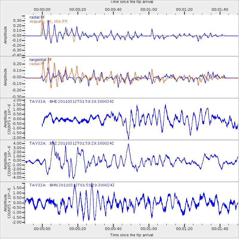
V32A Arapaho, OK, USA - Earthquake Result Viewer
*The percent match for this event was below the threshold and hence no stack was calculated.
| Earthquake location: |
Off East Coast Of Honshu, Japan |
| Earthquake latitude/longitude: |
37.6/142.6 |
| Earthquake time(UTC): |
2011/03/12 (071) 01:47:15 GMT |
| Earthquake Depth: |
20 km |
| Earthquake Magnitude: |
6.2 MB, 6.4 MS, 6.5 MW, 6.5 MW |
| Earthquake Catalog/Contributor: |
WHDF/NEIC |
|
| Network: |
TA USArray Transportable Network (new EarthScope stations) |
| Station: |
V32A Arapaho, OK, USA |
| Lat/Lon: |
35.72 N/99.04 W |
| Elevation: |
533 m |
|
| Distance: |
87.3 deg |
| Az: |
45.823 deg |
| Baz: |
315.565 deg |
| Ray Param: |
$rayparam |
*The percent match for this event was below the threshold and hence was not used in the summary stack. |
|
| Radial Match: |
79.5044 % |
| Radial Bump: |
400 |
| Transverse Match: |
78.74969 % |
| Transverse Bump: |
400 |
| SOD ConfigId: |
356183 |
| Insert Time: |
2011-08-19 08:23:45.507 +0000 |
| GWidth: |
2.5 |
| Max Bumps: |
400 |
| Tol: |
0.001 |
|
Signal To Noise
| Channel | StoN | STA | LTA |
| TA:V32A: :BHZ:20110312T01:59:29.300024Z | 6.3111935 | 1.5095857E-6 | 2.391918E-7 |
| TA:V32A: :BHN:20110312T01:59:29.300024Z | 1.1182488 | 3.138705E-7 | 2.8068035E-7 |
| TA:V32A: :BHE:20110312T01:59:29.300024Z | 1.4723636 | 3.69874E-7 | 2.5121102E-7 |
| Arrivals |
| Ps | |
| PpPs | |
| PsPs/PpSs | |


