You are here: Home > Network List > TA - USArray Transportable Network (new EarthScope stations) Stations List
> Station 433A Art, TX, USA > Earthquake Result Viewer
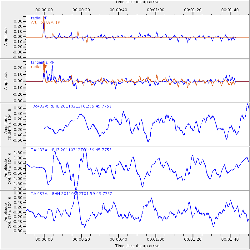
433A Art, TX, USA - Earthquake Result Viewer
*The percent match for this event was below the threshold and hence no stack was calculated.
| Earthquake location: |
Off East Coast Of Honshu, Japan |
| Earthquake latitude/longitude: |
37.6/142.6 |
| Earthquake time(UTC): |
2011/03/12 (071) 01:47:15 GMT |
| Earthquake Depth: |
20 km |
| Earthquake Magnitude: |
6.2 MB, 6.4 MS, 6.5 MW, 6.5 MW |
| Earthquake Catalog/Contributor: |
WHDF/NEIC |
|
| Network: |
TA USArray Transportable Network (new EarthScope stations) |
| Station: |
433A Art, TX, USA |
| Lat/Lon: |
30.75 N/99.09 W |
| Elevation: |
447 m |
|
| Distance: |
90.8 deg |
| Az: |
49.318 deg |
| Baz: |
315.595 deg |
| Ray Param: |
$rayparam |
*The percent match for this event was below the threshold and hence was not used in the summary stack. |
|
| Radial Match: |
69.65724 % |
| Radial Bump: |
400 |
| Transverse Match: |
71.97703 % |
| Transverse Bump: |
358 |
| SOD ConfigId: |
356183 |
| Insert Time: |
2011-08-19 08:27:06.749 +0000 |
| GWidth: |
2.5 |
| Max Bumps: |
400 |
| Tol: |
0.001 |
|
Signal To Noise
| Channel | StoN | STA | LTA |
| TA:433A: :BHZ:20110312T01:59:45.775Z | 3.7720866 | 8.798493E-7 | 2.3325269E-7 |
| TA:433A: :BHN:20110312T01:59:45.775Z | 1.9328873 | 1.6942704E-7 | 8.76549E-8 |
| TA:433A: :BHE:20110312T01:59:45.775Z | 1.3255757 | 2.792513E-7 | 2.1066417E-7 |
| Arrivals |
| Ps | |
| PpPs | |
| PsPs/PpSs | |


