You are here: Home > Network List > TA - USArray Transportable Network (new EarthScope stations) Stations List
> Station 238A Jacksonville, TX, USA > Earthquake Result Viewer
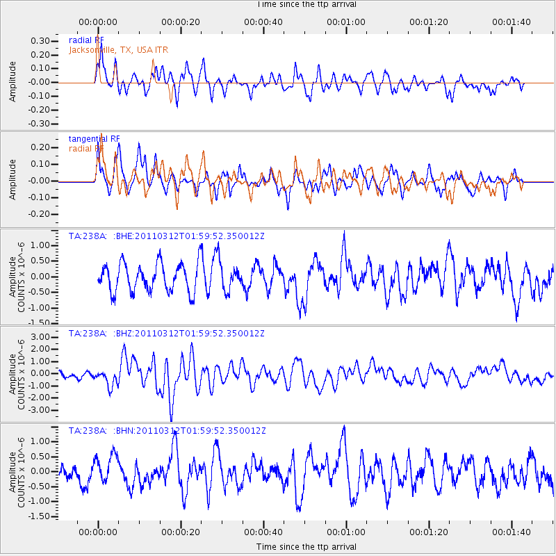
238A Jacksonville, TX, USA - Earthquake Result Viewer
*The percent match for this event was below the threshold and hence no stack was calculated.
| Earthquake location: |
Off East Coast Of Honshu, Japan |
| Earthquake latitude/longitude: |
37.6/142.6 |
| Earthquake time(UTC): |
2011/03/12 (071) 01:47:15 GMT |
| Earthquake Depth: |
20 km |
| Earthquake Magnitude: |
6.2 MB, 6.4 MS, 6.5 MW, 6.5 MW |
| Earthquake Catalog/Contributor: |
WHDF/NEIC |
|
| Network: |
TA USArray Transportable Network (new EarthScope stations) |
| Station: |
238A Jacksonville, TX, USA |
| Lat/Lon: |
32.00 N/95.12 W |
| Elevation: |
126 m |
|
| Distance: |
92.3 deg |
| Az: |
45.992 deg |
| Baz: |
317.744 deg |
| Ray Param: |
$rayparam |
*The percent match for this event was below the threshold and hence was not used in the summary stack. |
|
| Radial Match: |
71.6845 % |
| Radial Bump: |
400 |
| Transverse Match: |
59.432728 % |
| Transverse Bump: |
358 |
| SOD ConfigId: |
356183 |
| Insert Time: |
2011-08-19 08:38:37.931 +0000 |
| GWidth: |
2.5 |
| Max Bumps: |
400 |
| Tol: |
0.001 |
|
Signal To Noise
| Channel | StoN | STA | LTA |
| TA:238A: :BHZ:20110312T01:59:52.350012Z | 2.5528412 | 6.980887E-7 | 2.7345558E-7 |
| TA:238A: :BHN:20110312T01:59:52.350012Z | 1.9641485 | 4.5044382E-7 | 2.2933288E-7 |
| TA:238A: :BHE:20110312T01:59:52.350012Z | 0.95245636 | 4.2961858E-7 | 4.5106378E-7 |
| Arrivals |
| Ps | |
| PpPs | |
| PsPs/PpSs | |


