
W36A Wetumka, OK, USA - Earthquake Result Viewer
| ||||||||||||||||||
| ||||||||||||||||||
| ||||||||||||||||||
|
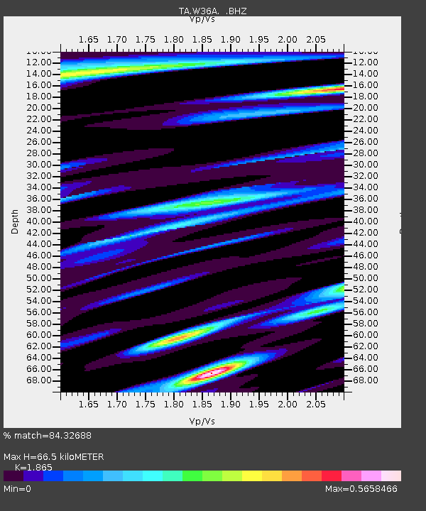
Signal To Noise
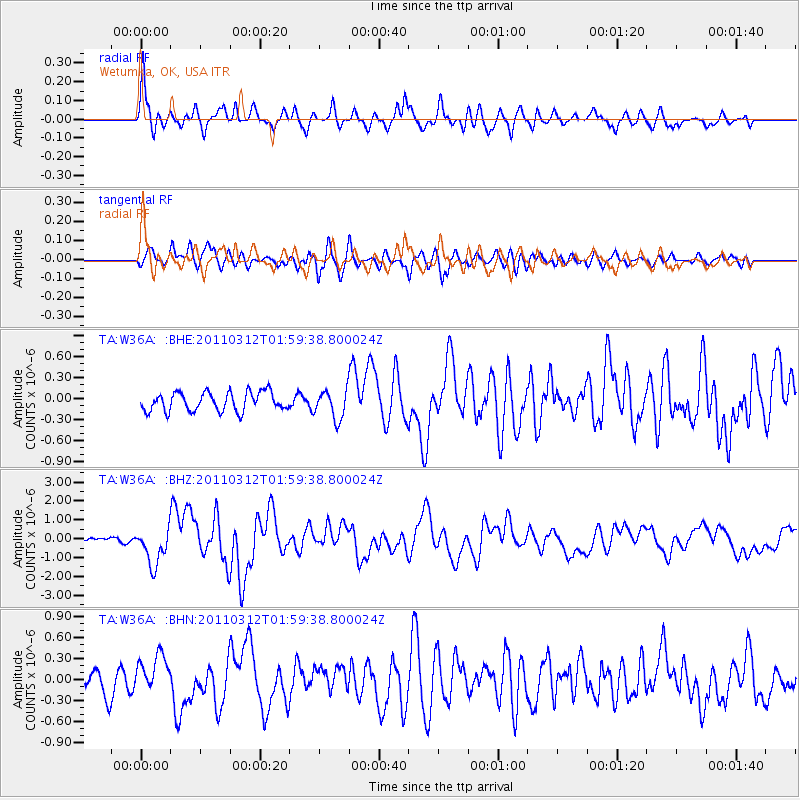
| Channel | StoN | STA | LTA |
| TA:W36A: :BHZ:20110312T01:59:38.800024Z | 7.335478 | 1.00354E-6 | 1.3680635E-7 |
| TA:W36A: :BHN:20110312T01:59:38.800024Z | 1.1914667 | 2.4348998E-7 | 2.0436154E-7 |
| TA:W36A: :BHE:20110312T01:59:38.800024Z | 1.5353477 | 2.0631111E-7 | 1.343742E-7 |
| Arrivals | |
| Ps | 9.1 SECOND |
| PpPs | 29 SECOND |
| PsPs/PpSs | 38 SECOND |

