RDM AZ.RDM - Earthquake Result Viewer
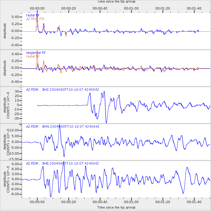
Earthquake location: Near S. Coast Of Western Honshu
Earthquake latitude/longitude: 33.1/136.6
Earthquake time(UTC): 2004/09/05 (249) 10:07:07 GMT
Earthquake Depth: 14 km
Earthquake Magnitude: 6.7 MB, 7.0 MS, 7.2 MW, 7.0 MW
Earthquake Catalog/Contributor: WHDF/NEIC
Network: AZ ANZA Regional Network
Station: RDM AZ.RDM
Lat/Lon: 33.63 N/116.85 W
Elevation: 1365 m
Distance: 84.3 deg
Az: 53.501 deg
Baz: 306.001 deg
Ray Param: 0.045602117
Estimated Moho Depth: 32.5 km
Estimated Crust Vp/Vs: 1.81
Assumed Crust Vp: 6.264 km/s
Estimated Crust Vs: 3.461 km/s
Estimated Crust Poisson's Ratio: 0.28
Radial Match: 95.52131 %
Radial Bump: 311
Transverse Match: 90.05793 %
Transverse Bump: 400
SOD ConfigId: 2459
Insert Time: 2010-02-26 20:28:01.445 +0000
GWidth: 2.5
Max Bumps: 400
Tol: 0.001

Signal To Noise

ChannelStoNSTALTA
AZ:RDM: :BHN:20040905T10:19:07.424004Z9.328422.9025946E-63.111561E-7
AZ:RDM: :BHE:20040905T10:19:07.424004Z12.7404843.5471292E-62.78414E-7
AZ:RDM: :BHZ:20040905T10:19:07.424004Z40.493651.21769035E-53.0071143E-7
Arrivals
Ps4.3 SECOND
PpPs14 SECOND
PsPs/PpSs19 SECOND