
N34A Lincoln, NE, USA - Earthquake Result Viewer
| ||||||||||||||||||
| ||||||||||||||||||
| ||||||||||||||||||
|
Signal To Noise
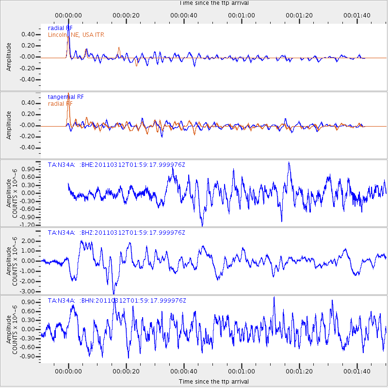
| Channel | StoN | STA | LTA |
| TA:N34A: :BHZ:20110312T01:59:17.999976Z | 8.583188 | 1.3024642E-6 | 1.5174597E-7 |
| TA:N34A: :BHN:20110312T01:59:17.999976Z | 2.1617017 | 4.901027E-7 | 2.2672077E-7 |
| TA:N34A: :BHE:20110312T01:59:17.999976Z | 2.1511328 | 3.0556248E-7 | 1.4204723E-7 |
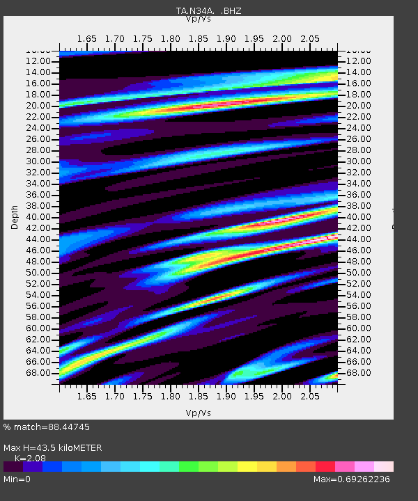
| Arrivals | |
| Ps | 7.4 SECOND |
| PpPs | 20 SECOND |
| PsPs/PpSs | 28 SECOND |

