
O36A Bolckow, MO, USA - Earthquake Result Viewer
| ||||||||||||||||||
| ||||||||||||||||||
| ||||||||||||||||||
|
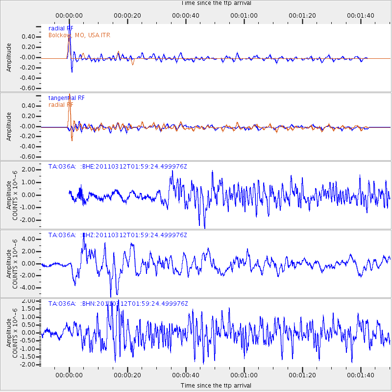
Signal To Noise
| Channel | StoN | STA | LTA |
| TA:O36A: :BHZ:20110312T01:59:24.499976Z | 8.001761 | 1.7240383E-6 | 2.1545735E-7 |
| TA:O36A: :BHN:20110312T01:59:24.499976Z | 2.3804743 | 4.6415653E-7 | 1.9498489E-7 |
| TA:O36A: :BHE:20110312T01:59:24.499976Z | 2.0665932 | 5.741979E-7 | 2.7784756E-7 |
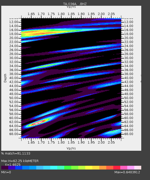
| Arrivals | |
| Ps | 6.7 SECOND |
| PpPs | 25 SECOND |
| PsPs/PpSs | 32 SECOND |

