V38A Canehill, AR, USA - Earthquake Result Viewer
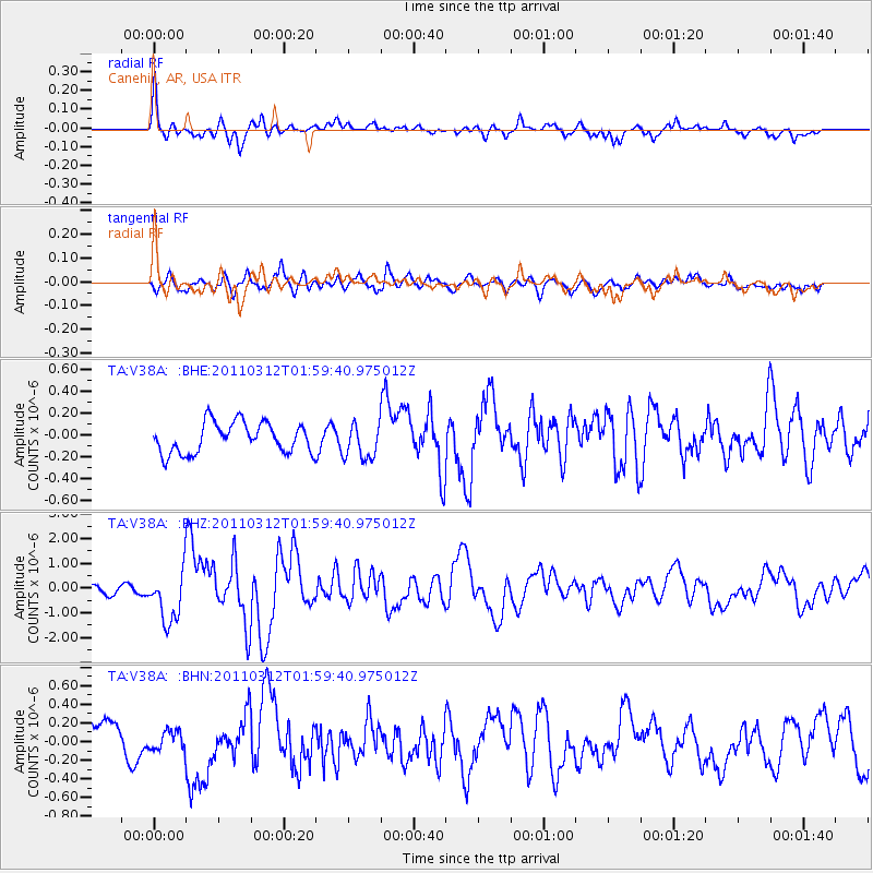
Earthquake location: Off East Coast Of Honshu, Japan
Earthquake latitude/longitude: 37.6/142.6
Earthquake time(UTC): 2011/03/12 (071) 01:47:15 GMT
Earthquake Depth: 20 km
Earthquake Magnitude: 6.2 MB, 6.4 MS, 6.5 MW, 6.5 MW
Earthquake Catalog/Contributor: WHDF/NEIC
Network: TA USArray Transportable Network (new EarthScope stations)
Station: V38A Canehill, AR, USA
Lat/Lon: 35.86 N/94.41 W
Elevation: 372 m
Distance: 89.8 deg
Az: 42.975 deg
Baz: 318.195 deg
Ray Param: 0.04171705
Estimated Moho Depth: 25.5 km
Estimated Crust Vp/Vs: 1.72
Assumed Crust Vp: 6.498 km/s
Estimated Crust Vs: 3.778 km/s
Estimated Crust Poisson's Ratio: 0.24
Radial Match: 81.33721 %
Radial Bump: 400
Transverse Match: 67.038925 %
Transverse Bump: 400
SOD ConfigId: 356183
Insert Time: 2011-08-19 08:58:19.038 +0000
GWidth: 2.5
Max Bumps: 400
Tol: 0.001

Signal To Noise

ChannelStoNSTALTA
TA:V38A: :BHZ:20110312T01:59:40.975012Z5.108211.053447E-62.0622626E-7
TA:V38A: :BHN:20110312T01:59:40.975012Z0.894142751.1141174E-71.2460174E-7
TA:V38A: :BHE:20110312T01:59:40.975012Z1.15079831.6069936E-71.3964164E-7
Arrivals
Ps2.9 SECOND
PpPs10 SECOND
PsPs/PpSs13 SECOND