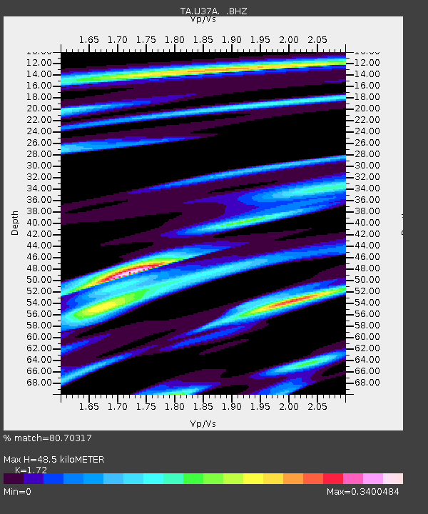
U37A Salina, OK, USA - Earthquake Result Viewer

Earthquake location: Off East Coast Of Honshu, Japan
Earthquake latitude/longitude: 37.6/142.6
Earthquake time(UTC): 2011/03/12 (071) 01:47:15 GMT
Earthquake Depth: 20 km
Earthquake Magnitude: 6.2 MB, 6.4 MS, 6.5 MW, 6.5 MW
Earthquake Catalog/Contributor: WHDF/NEIC
Network: TA USArray Transportable Network (new EarthScope stations)
Station: U37A Salina, OK, USA
Lat/Lon: 36.41 N/95.12 W
Elevation: 248 m
Distance: 89.0 deg
Az: 43.038 deg
Baz: 317.779 deg
Ray Param: 0.042140834
Estimated Moho Depth: 48.5 km
Estimated Crust Vp/Vs: 1.72
Assumed Crust Vp: 6.53 km/s
Estimated Crust Vs: 3.797 km/s
Estimated Crust Poisson's Ratio: 0.24
Radial Match: 80.70317 %
Radial Bump: 400
Transverse Match: 64.339134 %
Transverse Bump: 400
SOD ConfigId: 356183
Insert Time: 2011-08-19 08:59:38.793 +0000
GWidth: 2.5
Max Bumps: 400
Tol: 0.001

Signal To Noise

ChannelStoNSTALTA
TA:U37A: :BHZ:20110312T01:59:37.300024Z7.00394541.1265747E-61.6084859E-7
TA:U37A: :BHN:20110312T01:59:37.300024Z2.1704163.106328E-71.4312131E-7
TA:U37A: :BHE:20110312T01:59:37.300024Z1.80358062.9098302E-71.613363E-7
Arrivals
Ps5.5 SECOND
PpPs20 SECOND
PsPs/PpSs25 SECOND