
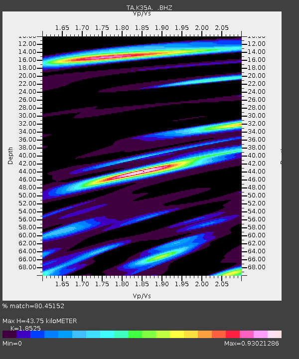
K35A Storm Lake, IA, USA - Earthquake Result Viewer
| ||||||||||||||||||
| ||||||||||||||||||
| ||||||||||||||||||
|
Signal To Noise
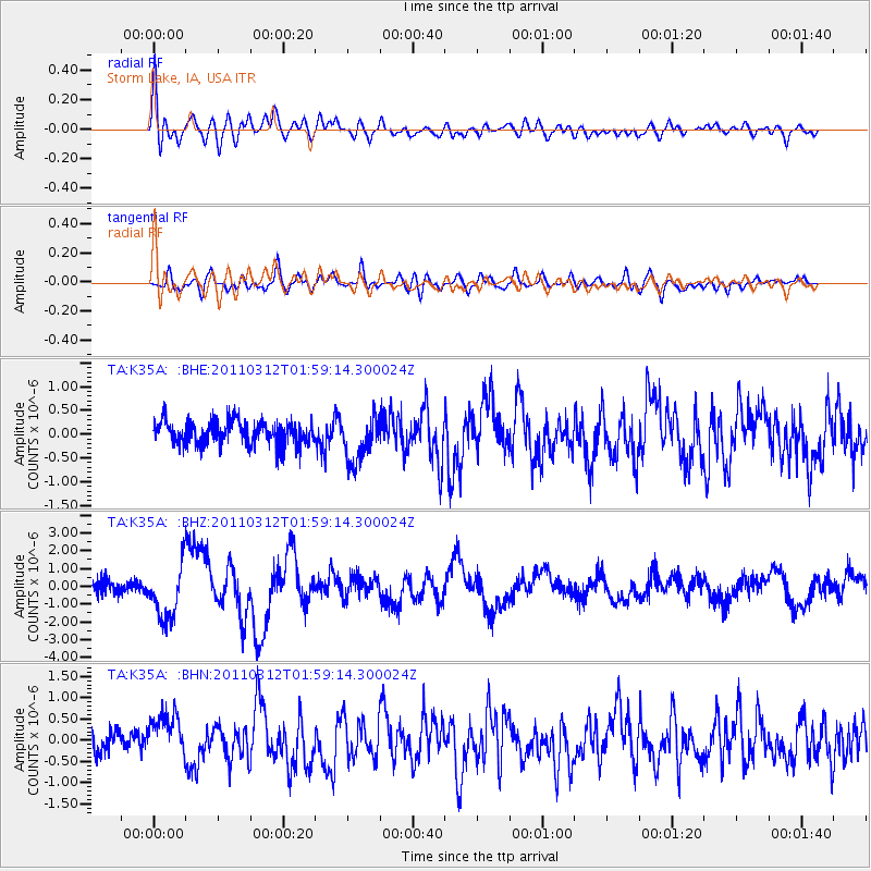
| Channel | StoN | STA | LTA |
| TA:K35A: :BHZ:20110312T01:59:14.300024Z | 3.8025918 | 1.5156049E-6 | 3.9857156E-7 |
| TA:K35A: :BHN:20110312T01:59:14.300024Z | 2.0087726 | 5.193804E-7 | 2.5855613E-7 |
| TA:K35A: :BHE:20110312T01:59:14.300024Z | 1.9271903 | 4.8283545E-7 | 2.5053853E-7 |
| Arrivals | |
| Ps | 5.9 SECOND |
| PpPs | 19 SECOND |
| PsPs/PpSs | 24 SECOND |

