D35A Remer, MN, USA - Earthquake Result Viewer
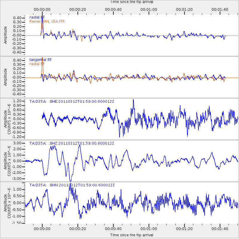
Earthquake location: Off East Coast Of Honshu, Japan
Earthquake latitude/longitude: 37.6/142.6
Earthquake time(UTC): 2011/03/12 (071) 01:47:15 GMT
Earthquake Depth: 20 km
Earthquake Magnitude: 6.2 MB, 6.4 MS, 6.5 MW, 6.5 MW
Earthquake Catalog/Contributor: WHDF/NEIC
Network: TA USArray Transportable Network (new EarthScope stations)
Station: D35A Remer, MN, USA
Lat/Lon: 47.08 N/94.05 W
Elevation: 427 m
Distance: 81.6 deg
Az: 35.264 deg
Baz: 317.852 deg
Ray Param: 0.04742898
Estimated Moho Depth: 39.5 km
Estimated Crust Vp/Vs: 1.64
Assumed Crust Vp: 6.419 km/s
Estimated Crust Vs: 3.902 km/s
Estimated Crust Poisson's Ratio: 0.21
Radial Match: 89.29428 %
Radial Bump: 400
Transverse Match: 69.61938 %
Transverse Bump: 400
SOD ConfigId: 356183
Insert Time: 2011-08-19 09:15:14.492 +0000
GWidth: 2.5
Max Bumps: 400
Tol: 0.001

Signal To Noise

ChannelStoNSTALTA
TA:D35A: :BHZ:20110312T01:59:00.600012Z8.1578421.6129444E-61.9771704E-7
TA:D35A: :BHN:20110312T01:59:00.600012Z3.81967955.7616944E-71.5084235E-7
TA:D35A: :BHE:20110312T01:59:00.600012Z2.21122623.67799E-71.6633261E-7
Arrivals
Ps4.1 SECOND
PpPs16 SECOND
PsPs/PpSs20 SECOND