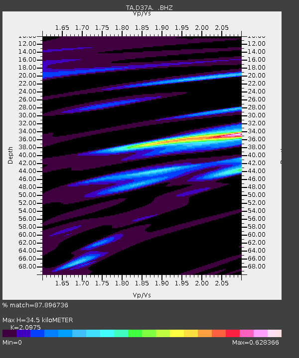
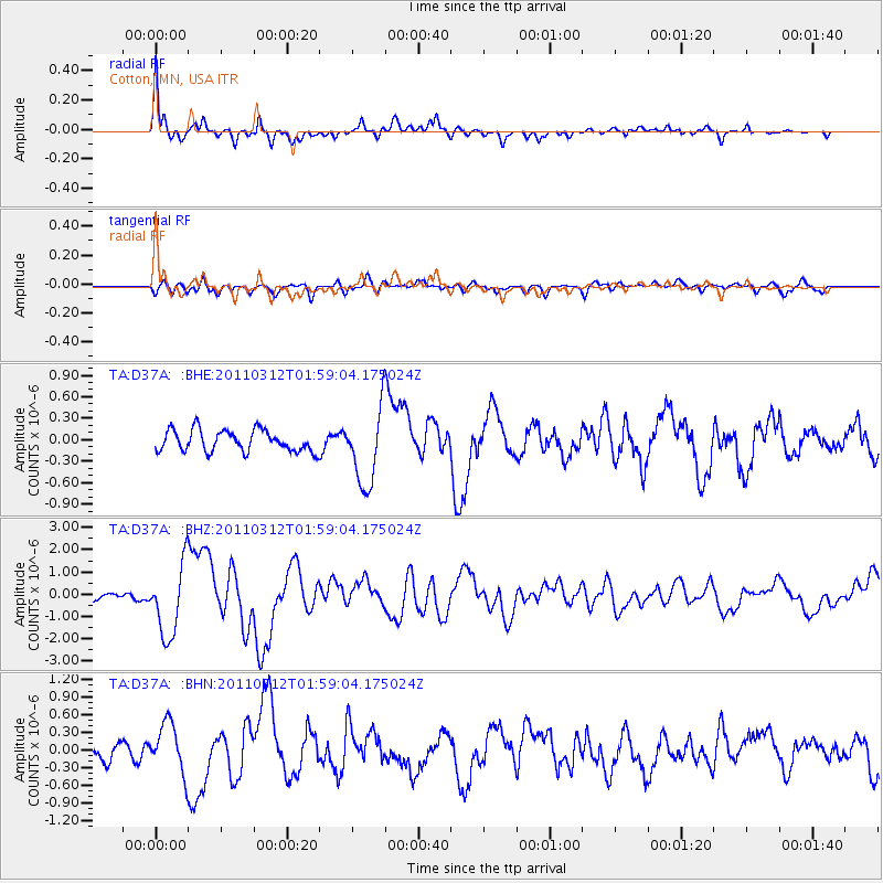
D37A Cotton, MN, USA - Earthquake Result Viewer

Earthquake location: Off East Coast Of Honshu, Japan
Earthquake latitude/longitude: 37.6/142.6
Earthquake time(UTC): 2011/03/12 (071) 01:47:15 GMT
Earthquake Depth: 20 km
Earthquake Magnitude: 6.2 MB, 6.4 MS, 6.5 MW, 6.5 MW
Earthquake Catalog/Contributor: WHDF/NEIC
Network: TA USArray Transportable Network (new EarthScope stations)
Station: D37A Cotton, MN, USA
Lat/Lon: 47.16 N/92.43 W
Elevation: 413 m
Distance: 82.3 deg
Az: 34.374 deg
Baz: 318.916 deg
Ray Param: 0.04695368
Estimated Moho Depth: 34.5 km
Estimated Crust Vp/Vs: 2.10
Assumed Crust Vp: 6.571 km/s
Estimated Crust Vs: 3.133 km/s
Estimated Crust Poisson's Ratio: 0.35
Radial Match: 87.896736 %
Radial Bump: 400
Transverse Match: 64.08279 %
Transverse Bump: 400
SOD ConfigId: 356183
Insert Time: 2011-08-19 09:16:02.925 +0000
GWidth: 2.5
Max Bumps: 400
Tol: 0.001

Signal To Noise

ChannelStoNSTALTA
TA:D37A: :BHZ:20110312T01:59:04.175024Z8.8681811.5939371E-61.7973665E-7
TA:D37A: :BHN:20110312T01:59:04.175024Z2.06672644.182215E-72.0235939E-7
TA:D37A: :BHE:20110312T01:59:04.175024Z3.61015155.3537E-71.4829573E-7
Arrivals
Ps5.9 SECOND
PpPs16 SECOND
PsPs/PpSs22 SECOND