C06D Leavenworth, WQ, USA - Earthquake Result Viewer
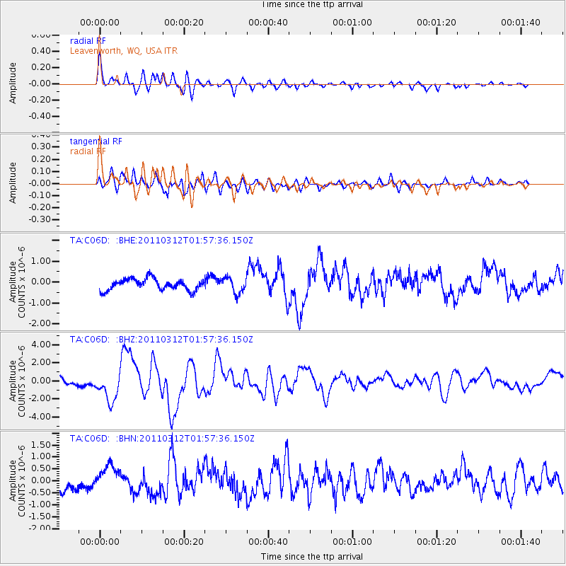
Earthquake location: Off East Coast Of Honshu, Japan
Earthquake latitude/longitude: 37.6/142.6
Earthquake time(UTC): 2011/03/12 (071) 01:47:15 GMT
Earthquake Depth: 20 km
Earthquake Magnitude: 6.2 MB, 6.4 MS, 6.5 MW, 6.5 MW
Earthquake Catalog/Contributor: WHDF/NEIC
Network: TA USArray Transportable Network (new EarthScope stations)
Station: C06D Leavenworth, WQ, USA
Lat/Lon: 47.92 N/120.89 W
Elevation: 544 m
Distance: 67.1 deg
Az: 46.521 deg
Baz: 301.024 deg
Ray Param: 0.05716935
Estimated Moho Depth: 46.5 km
Estimated Crust Vp/Vs: 1.61
Assumed Crust Vp: 6.597 km/s
Estimated Crust Vs: 4.104 km/s
Estimated Crust Poisson's Ratio: 0.18
Radial Match: 84.62796 %
Radial Bump: 400
Transverse Match: 79.45438 %
Transverse Bump: 400
SOD ConfigId: 356183
Insert Time: 2011-08-19 09:16:45.390 +0000
GWidth: 2.5
Max Bumps: 400
Tol: 0.001

Signal To Noise

ChannelStoNSTALTA
TA:C06D: :BHZ:20110312T01:57:36.150Z4.2749271.6689789E-63.904111E-7
TA:C06D: :BHN:20110312T01:57:36.150Z2.0489625.500663E-72.6846095E-7
TA:C06D: :BHE:20110312T01:57:36.150Z1.38070823.789008E-72.7442496E-7
Arrivals
Ps4.5 SECOND
PpPs18 SECOND
PsPs/PpSs22 SECOND