G31A Conde, SD, USA - Earthquake Result Viewer
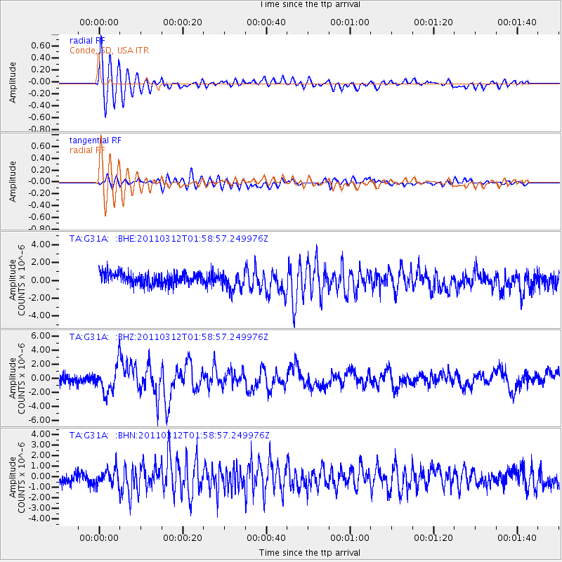
Earthquake location: Off East Coast Of Honshu, Japan
Earthquake latitude/longitude: 37.6/142.6
Earthquake time(UTC): 2011/03/12 (071) 01:47:15 GMT
Earthquake Depth: 20 km
Earthquake Magnitude: 6.2 MB, 6.4 MS, 6.5 MW, 6.5 MW
Earthquake Catalog/Contributor: WHDF/NEIC
Network: TA USArray Transportable Network (new EarthScope stations)
Station: G31A Conde, SD, USA
Lat/Lon: 45.23 N/98.21 W
Elevation: 393 m
Distance: 81.0 deg
Az: 38.677 deg
Baz: 315.379 deg
Ray Param: 0.047875777
Estimated Moho Depth: 22.5 km
Estimated Crust Vp/Vs: 1.80
Assumed Crust Vp: 6.53 km/s
Estimated Crust Vs: 3.628 km/s
Estimated Crust Poisson's Ratio: 0.28
Radial Match: 87.18246 %
Radial Bump: 400
Transverse Match: 81.61101 %
Transverse Bump: 400
SOD ConfigId: 356183
Insert Time: 2011-08-19 09:17:00.280 +0000
GWidth: 2.5
Max Bumps: 400
Tol: 0.001

Signal To Noise

ChannelStoNSTALTA
TA:G31A: :BHZ:20110312T01:58:57.249976Z3.7984721.9736592E-65.1959296E-7
TA:G31A: :BHN:20110312T01:58:57.249976Z1.5378167.2575244E-74.7193708E-7
TA:G31A: :BHE:20110312T01:58:57.249976Z1.51941249.910735E-76.522742E-7
Arrivals
Ps2.8 SECOND
PpPs9.4 SECOND
PsPs/PpSs12 SECOND