
RDM AZ.RDM - Earthquake Result Viewer
| ||||||||||||||||||
| ||||||||||||||||||
| ||||||||||||||||||
|
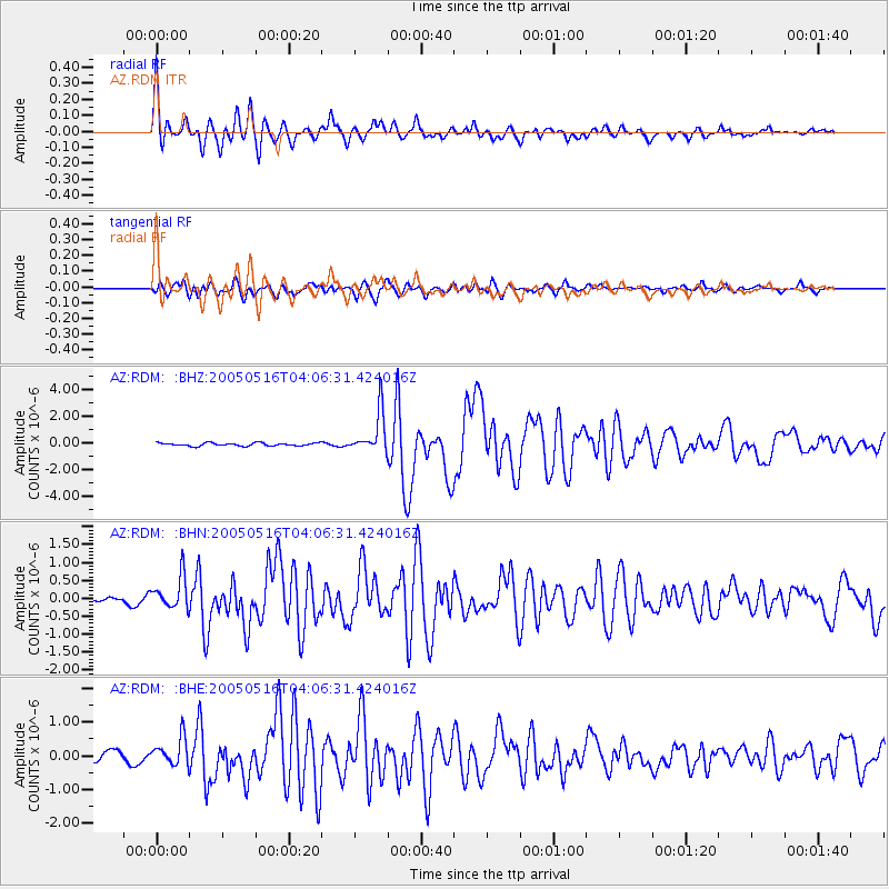
Signal To Noise
| Channel | StoN | STA | LTA |
| AZ:RDM: :BHN:20050516T04:06:31.424016Z | 5.057022 | 4.5086577E-7 | 8.915637E-8 |
| AZ:RDM: :BHE:20050516T04:06:31.424016Z | 3.5455363 | 3.997121E-7 | 1.1273671E-7 |
| AZ:RDM: :BHZ:20050516T04:06:31.424016Z | 14.001568 | 1.5470803E-6 | 1.1049337E-7 |
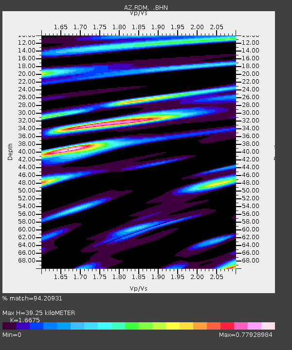
| Arrivals | |
| Ps | 4.3 SECOND |
| PpPs | 16 SECOND |
| PsPs/PpSs | 21 SECOND |

