A33A Warroad, MN, USA - Earthquake Result Viewer
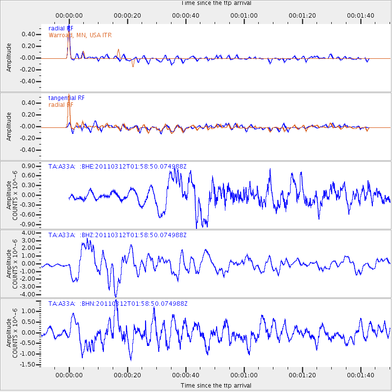
Earthquake location: Off East Coast Of Honshu, Japan
Earthquake latitude/longitude: 37.6/142.6
Earthquake time(UTC): 2011/03/12 (071) 01:47:15 GMT
Earthquake Depth: 20 km
Earthquake Magnitude: 6.2 MB, 6.4 MS, 6.5 MW, 6.5 MW
Earthquake Catalog/Contributor: WHDF/NEIC
Network: TA USArray Transportable Network (new EarthScope stations)
Station: A33A Warroad, MN, USA
Lat/Lon: 48.94 N/95.39 W
Elevation: 329 m
Distance: 79.7 deg
Az: 34.657 deg
Baz: 316.762 deg
Ray Param: 0.04878874
Estimated Moho Depth: 27.75 km
Estimated Crust Vp/Vs: 2.07
Assumed Crust Vp: 6.419 km/s
Estimated Crust Vs: 3.097 km/s
Estimated Crust Poisson's Ratio: 0.35
Radial Match: 92.43711 %
Radial Bump: 394
Transverse Match: 76.28312 %
Transverse Bump: 400
SOD ConfigId: 356183
Insert Time: 2011-08-19 09:22:53.379 +0000
GWidth: 2.5
Max Bumps: 400
Tol: 0.001

Signal To Noise

ChannelStoNSTALTA
TA:A33A: :BHZ:20110312T01:58:50.074988Z10.0095861.6232055E-61.621651E-7
TA:A33A: :BHN:20110312T01:58:50.074988Z3.23605065.916774E-71.8283936E-7
TA:A33A: :BHE:20110312T01:58:50.074988Z4.020274.7463686E-71.18060946E-7
Arrivals
Ps4.8 SECOND
PpPs13 SECOND
PsPs/PpSs18 SECOND