You are here: Home > Network List > TA - USArray Transportable Network (new EarthScope stations) Stations List
> Station E37A Wrenshall, MN, USA > Earthquake Result Viewer
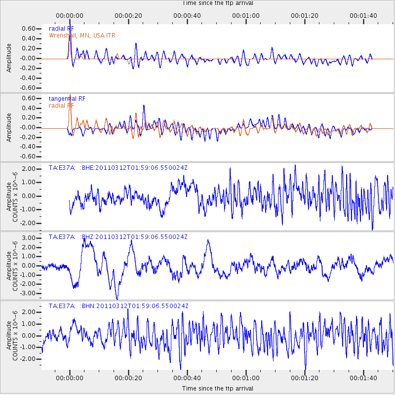
E37A Wrenshall, MN, USA - Earthquake Result Viewer
*The percent match for this event was below the threshold and hence no stack was calculated.
| Earthquake location: |
Off East Coast Of Honshu, Japan |
| Earthquake latitude/longitude: |
37.6/142.6 |
| Earthquake time(UTC): |
2011/03/12 (071) 01:47:15 GMT |
| Earthquake Depth: |
20 km |
| Earthquake Magnitude: |
6.2 MB, 6.4 MS, 6.5 MW, 6.5 MW |
| Earthquake Catalog/Contributor: |
WHDF/NEIC |
|
| Network: |
TA USArray Transportable Network (new EarthScope stations) |
| Station: |
E37A Wrenshall, MN, USA |
| Lat/Lon: |
46.57 N/92.40 W |
| Elevation: |
304 m |
|
| Distance: |
82.8 deg |
| Az: |
34.753 deg |
| Baz: |
318.984 deg |
| Ray Param: |
$rayparam |
*The percent match for this event was below the threshold and hence was not used in the summary stack. |
|
| Radial Match: |
64.482475 % |
| Radial Bump: |
400 |
| Transverse Match: |
49.516956 % |
| Transverse Bump: |
400 |
| SOD ConfigId: |
356183 |
| Insert Time: |
2011-08-19 09:26:21.682 +0000 |
| GWidth: |
2.5 |
| Max Bumps: |
400 |
| Tol: |
0.001 |
|
Signal To Noise
| Channel | StoN | STA | LTA |
| TA:E37A: :BHZ:20110312T01:59:06.550024Z | 8.18516 | 1.5955442E-6 | 1.9493135E-7 |
| TA:E37A: :BHN:20110312T01:59:06.550024Z | 2.2420413 | 9.546698E-7 | 4.2580382E-7 |
| TA:E37A: :BHE:20110312T01:59:06.550024Z | 1.7164946 | 7.2413195E-7 | 4.218667E-7 |
| Arrivals |
| Ps | |
| PpPs | |
| PsPs/PpSs | |


