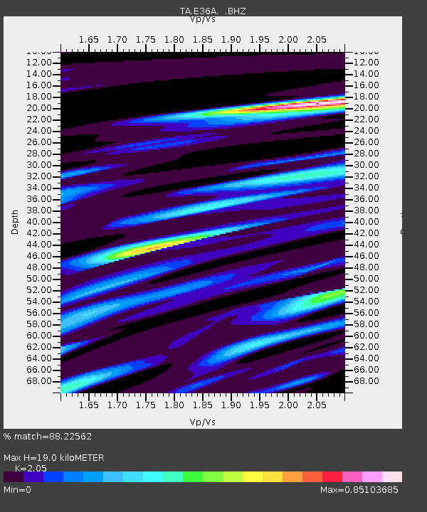
E36A McGregor, MN, USA - Earthquake Result Viewer
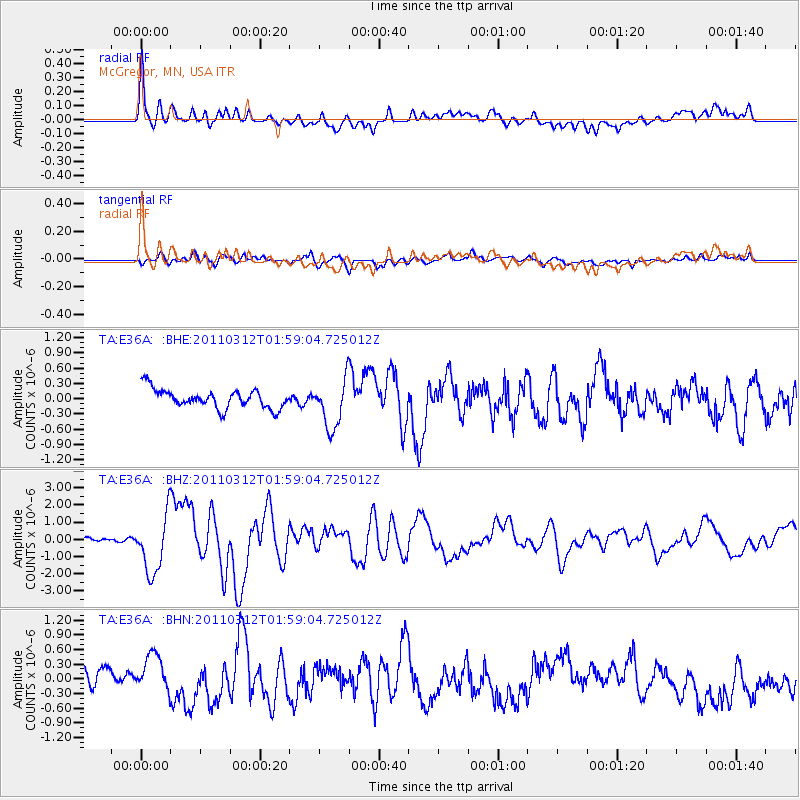
Earthquake location: Off East Coast Of Honshu, Japan
Earthquake latitude/longitude: 37.6/142.6
Earthquake time(UTC): 2011/03/12 (071) 01:47:15 GMT
Earthquake Depth: 20 km
Earthquake Magnitude: 6.2 MB, 6.4 MS, 6.5 MW, 6.5 MW
Earthquake Catalog/Contributor: WHDF/NEIC
Network: TA USArray Transportable Network (new EarthScope stations)
Station: E36A McGregor, MN, USA
Lat/Lon: 46.52 N/93.26 W
Elevation: 393 m
Distance: 82.4 deg
Az: 35.232 deg
Baz: 318.427 deg
Ray Param: 0.046880912
Estimated Moho Depth: 19.0 km
Estimated Crust Vp/Vs: 2.05
Assumed Crust Vp: 6.571 km/s
Estimated Crust Vs: 3.205 km/s
Estimated Crust Poisson's Ratio: 0.34
Radial Match: 88.22562 %
Radial Bump: 400
Transverse Match: 62.42805 %
Transverse Bump: 400
SOD ConfigId: 356183
Insert Time: 2011-08-19 09:27:03.991 +0000
GWidth: 2.5
Max Bumps: 400
Tol: 0.001

Signal To Noise

ChannelStoNSTALTA
TA:E36A: :BHZ:20110312T01:59:04.725012Z12.0105031.6624423E-61.384157E-7
TA:E36A: :BHN:20110312T01:59:04.725012Z2.02937344.0176826E-71.9797652E-7
TA:E36A: :BHE:20110312T01:59:04.725012Z2.56380274.800043E-71.8722359E-7
Arrivals
Ps3.1 SECOND
PpPs8.6 SECOND
PsPs/PpSs12 SECOND