RDM AZ.RDM - Earthquake Result Viewer
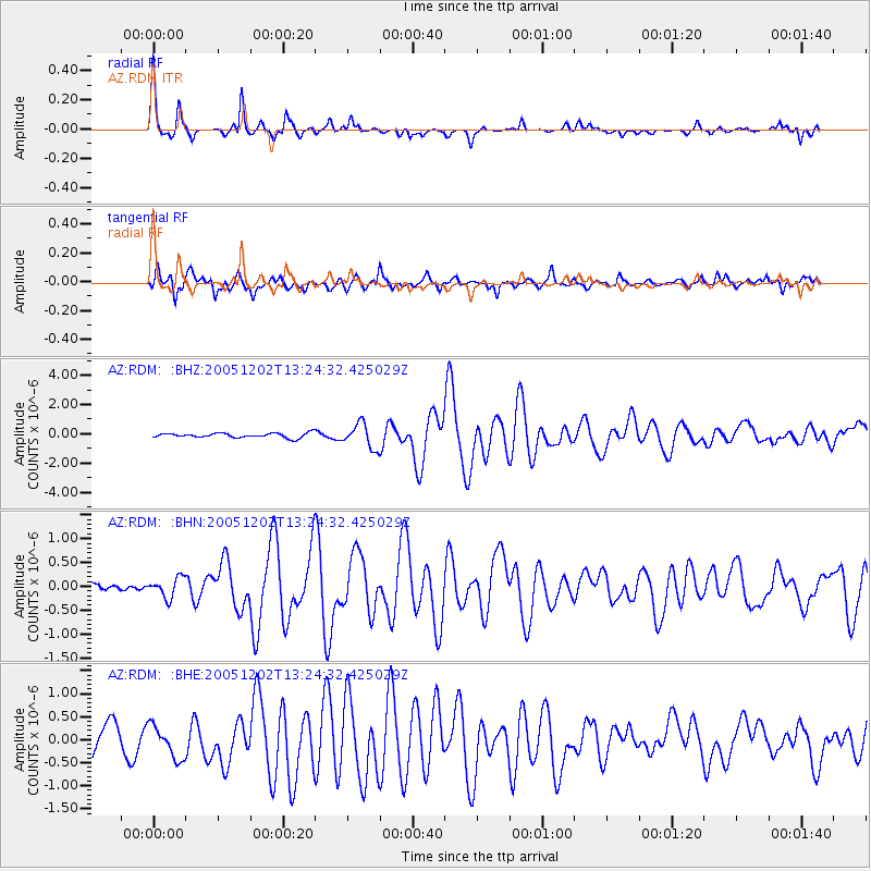
Earthquake location: Near East Coast Of Honshu, Japan
Earthquake latitude/longitude: 38.1/142.1
Earthquake time(UTC): 2005/12/02 (336) 13:13:09 GMT
Earthquake Depth: 29 km
Earthquake Magnitude: 6.1 MB, 6.3 MS, 6.5 MW, 6.4 MW
Earthquake Catalog/Contributor: WHDF/NEIC
Network: AZ ANZA Regional Network
Station: RDM AZ.RDM
Lat/Lon: 33.63 N/116.85 W
Elevation: 1365 m
Distance: 77.7 deg
Az: 56.94 deg
Baz: 307.569 deg
Ray Param: 0.050092503
Estimated Moho Depth: 32.0 km
Estimated Crust Vp/Vs: 1.74
Assumed Crust Vp: 6.264 km/s
Estimated Crust Vs: 3.605 km/s
Estimated Crust Poisson's Ratio: 0.25
Radial Match: 93.68483 %
Radial Bump: 257
Transverse Match: 80.70815 %
Transverse Bump: 400
SOD ConfigId: 2422
Insert Time: 2010-02-26 20:28:39.008 +0000
GWidth: 2.5
Max Bumps: 400
Tol: 0.001

Signal To Noise

ChannelStoNSTALTA
AZ:RDM: :BHN:20051202T13:24:32.425029Z1.54057922.0964033E-71.360789E-7
AZ:RDM: :BHE:20051202T13:24:32.425029Z1.58616833.5643453E-72.2471419E-7
AZ:RDM: :BHZ:20051202T13:24:32.425029Z5.3858328.331306E-71.5468932E-7
Arrivals
Ps3.9 SECOND
PpPs14 SECOND
PsPs/PpSs17 SECOND