S39A Bolivar, MO, USA - Earthquake Result Viewer
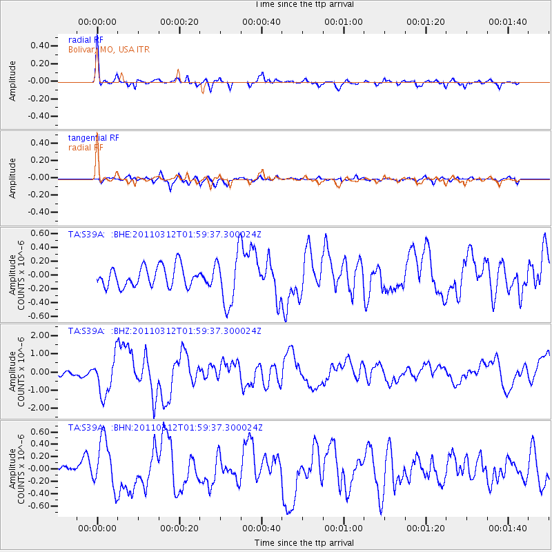
Earthquake location: Off East Coast Of Honshu, Japan
Earthquake latitude/longitude: 37.6/142.6
Earthquake time(UTC): 2011/03/12 (071) 01:47:15 GMT
Earthquake Depth: 20 km
Earthquake Magnitude: 6.2 MB, 6.4 MS, 6.5 MW, 6.5 MW
Earthquake Catalog/Contributor: WHDF/NEIC
Network: TA USArray Transportable Network (new EarthScope stations)
Station: S39A Bolivar, MO, USA
Lat/Lon: 37.69 N/93.32 W
Elevation: 331 m
Distance: 89.0 deg
Az: 41.113 deg
Baz: 318.822 deg
Ray Param: 0.04214304
Estimated Moho Depth: 50.5 km
Estimated Crust Vp/Vs: 1.61
Assumed Crust Vp: 6.53 km/s
Estimated Crust Vs: 4.05 km/s
Estimated Crust Poisson's Ratio: 0.19
Radial Match: 87.15303 %
Radial Bump: 319
Transverse Match: 63.220905 %
Transverse Bump: 400
SOD ConfigId: 356183
Insert Time: 2011-08-19 09:39:08.410 +0000
GWidth: 2.5
Max Bumps: 400
Tol: 0.001

Signal To Noise

ChannelStoNSTALTA
TA:S39A: :BHZ:20110312T01:59:37.300024Z5.840121.0933674E-61.872166E-7
TA:S39A: :BHN:20110312T01:59:37.300024Z2.77853234.0865083E-71.4707435E-7
TA:S39A: :BHE:20110312T01:59:37.300024Z2.6502443.868206E-71.459566E-7
Arrivals
Ps4.9 SECOND
PpPs20 SECOND
PsPs/PpSs25 SECOND