
T40A Mansfield, MO, USA - Earthquake Result Viewer
| ||||||||||||||||||
| ||||||||||||||||||
| ||||||||||||||||||
|
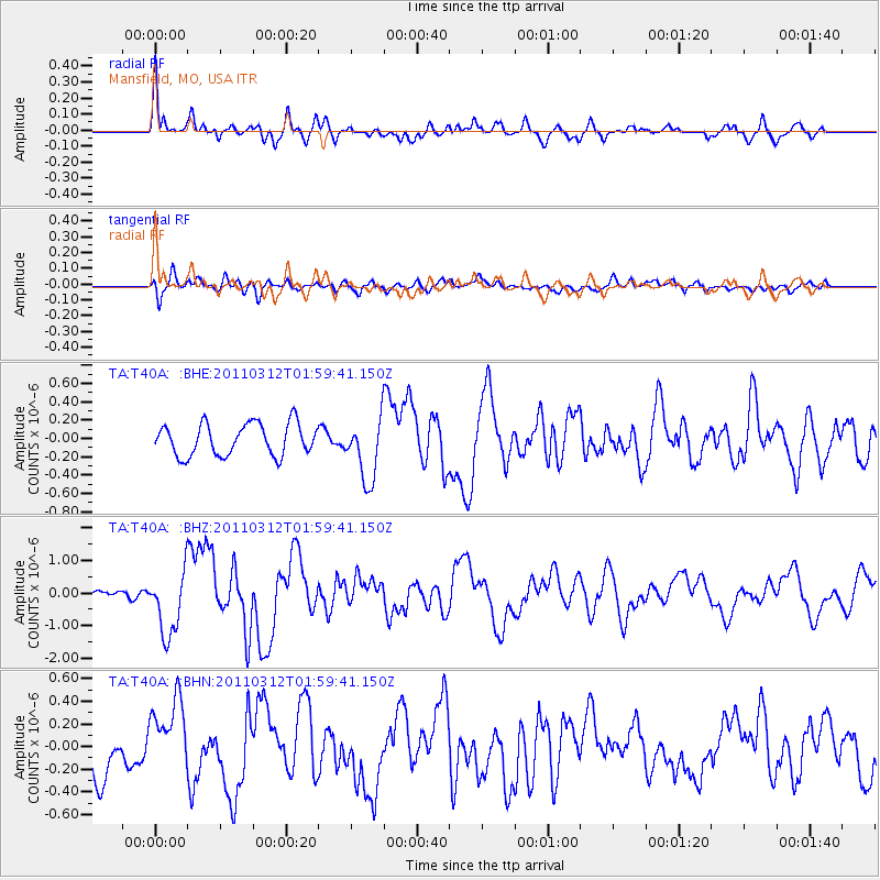
Signal To Noise
| Channel | StoN | STA | LTA |
| TA:T40A: :BHZ:20110312T01:59:41.150Z | 8.719889 | 1.0124539E-6 | 1.1610859E-7 |
| TA:T40A: :BHN:20110312T01:59:41.150Z | 1.8468834 | 3.1253927E-7 | 1.6922523E-7 |
| TA:T40A: :BHE:20110312T01:59:41.150Z | 1.9911062 | 3.453015E-7 | 1.7342194E-7 |
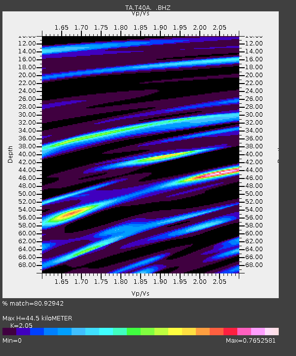
| Arrivals | |
| Ps | 7.3 SECOND |
| PpPs | 20 SECOND |
| PsPs/PpSs | 28 SECOND |

