DGMT Dagmar, Montana, USA - Earthquake Result Viewer
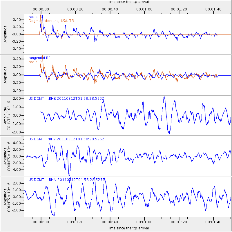
Earthquake location: Off East Coast Of Honshu, Japan
Earthquake latitude/longitude: 37.6/142.6
Earthquake time(UTC): 2011/03/12 (071) 01:47:15 GMT
Earthquake Depth: 20 km
Earthquake Magnitude: 6.2 MB, 6.4 MS, 6.5 MW, 6.5 MW
Earthquake Catalog/Contributor: WHDF/NEIC
Network: US United States National Seismic Network
Station: DGMT Dagmar, Montana, USA
Lat/Lon: 48.47 N/104.20 W
Elevation: 0.0 m
Distance: 75.8 deg
Az: 39.139 deg
Baz: 311.115 deg
Ray Param: 0.051414836
Estimated Moho Depth: 59.75 km
Estimated Crust Vp/Vs: 1.73
Assumed Crust Vp: 6.438 km/s
Estimated Crust Vs: 3.732 km/s
Estimated Crust Poisson's Ratio: 0.25
Radial Match: 83.65596 %
Radial Bump: 400
Transverse Match: 74.87063 %
Transverse Bump: 400
SOD ConfigId: 356183
Insert Time: 2011-08-19 09:59:12.956 +0000
GWidth: 2.5
Max Bumps: 400
Tol: 0.001

Signal To Noise

ChannelStoNSTALTA
US:DGMT: :BHZ:20110312T01:58:28.525Z6.94021651.8305464E-62.6375926E-7
US:DGMT: :BHN:20110312T01:58:28.525Z1.7990778.608388E-74.7848914E-7
US:DGMT: :BHE:20110312T01:58:28.525Z2.37564928.1394035E-73.4261808E-7
Arrivals
Ps7.0 SECOND
PpPs24 SECOND
PsPs/PpSs31 SECOND