You are here: Home > Network List > CN - Canadian National Seismograph Network Stations List
> Station LLLB LILLOOET, BC, CANADA ADA > Earthquake Result Viewer
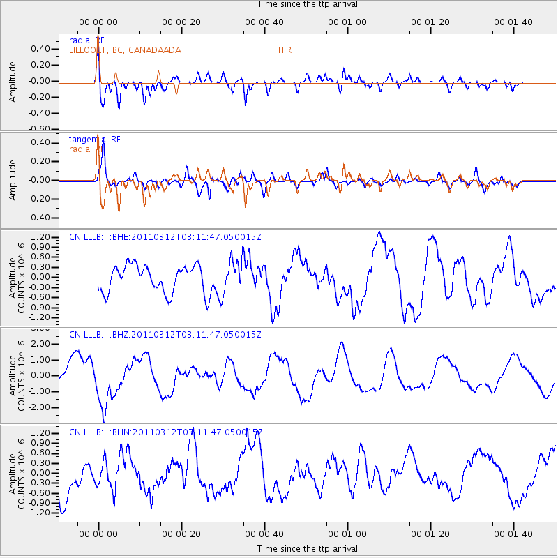
LLLB LILLOOET, BC, CANADA ADA - Earthquake Result Viewer
*The percent match for this event was below the threshold and hence no stack was calculated.
| Earthquake location: |
Near East Coast Of Honshu, Japan |
| Earthquake latitude/longitude: |
39.5/142.6 |
| Earthquake time(UTC): |
2011/03/12 (071) 03:01:47 GMT |
| Earthquake Depth: |
20 km |
| Earthquake Magnitude: |
5.8 MB |
| Earthquake Catalog/Contributor: |
WHDF/NEIC |
|
| Network: |
CN Canadian National Seismograph Network |
| Station: |
LLLB LILLOOET, BC, CANADA ADA |
| Lat/Lon: |
50.61 N/121.88 W |
| Elevation: |
700 m |
|
| Distance: |
63.8 deg |
| Az: |
44.973 deg |
| Baz: |
300.945 deg |
| Ray Param: |
$rayparam |
*The percent match for this event was below the threshold and hence was not used in the summary stack. |
|
| Radial Match: |
63.155354 % |
| Radial Bump: |
400 |
| Transverse Match: |
66.938255 % |
| Transverse Bump: |
400 |
| SOD ConfigId: |
356183 |
| Insert Time: |
2011-08-19 11:38:19.549 +0000 |
| GWidth: |
2.5 |
| Max Bumps: |
400 |
| Tol: |
0.001 |
|
Signal To Noise
| Channel | StoN | STA | LTA |
| CN:LLLB: :BHZ:20110312T03:11:47.050015Z | 2.0747406 | 1.481861E-6 | 7.1423915E-7 |
| CN:LLLB: :BHN:20110312T03:11:47.050015Z | 0.875277 | 3.9733385E-7 | 4.5395214E-7 |
| CN:LLLB: :BHE:20110312T03:11:47.050015Z | 1.3775374 | 5.116896E-7 | 3.7145247E-7 |
| Arrivals |
| Ps | |
| PpPs | |
| PsPs/PpSs | |


