You are here: Home > Network List > TA - USArray Transportable Network (new EarthScope stations) Stations List
> Station MSTX Muleshoe, TX, USA > Earthquake Result Viewer
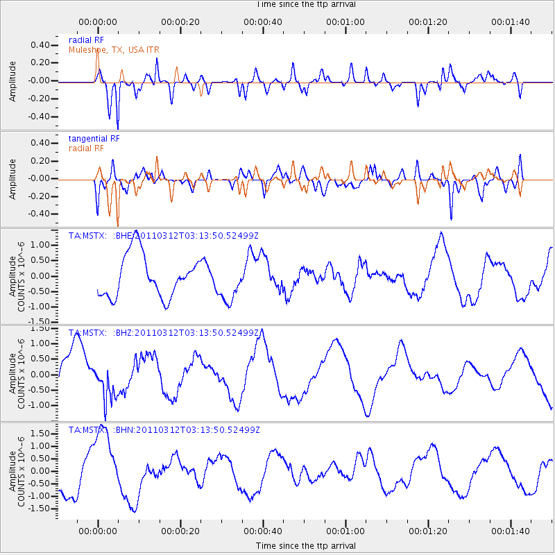
MSTX Muleshoe, TX, USA - Earthquake Result Viewer
*The percent match for this event was below the threshold and hence no stack was calculated.
| Earthquake location: |
Near East Coast Of Honshu, Japan |
| Earthquake latitude/longitude: |
39.5/142.6 |
| Earthquake time(UTC): |
2011/03/12 (071) 03:01:47 GMT |
| Earthquake Depth: |
20 km |
| Earthquake Magnitude: |
5.8 MB |
| Earthquake Catalog/Contributor: |
WHDF/NEIC |
|
| Network: |
TA USArray Transportable Network (new EarthScope stations) |
| Station: |
MSTX Muleshoe, TX, USA |
| Lat/Lon: |
33.97 N/102.77 W |
| Elevation: |
1167 m |
|
| Distance: |
85.1 deg |
| Az: |
49.306 deg |
| Baz: |
315.14 deg |
| Ray Param: |
$rayparam |
*The percent match for this event was below the threshold and hence was not used in the summary stack. |
|
| Radial Match: |
76.63803 % |
| Radial Bump: |
400 |
| Transverse Match: |
47.127045 % |
| Transverse Bump: |
400 |
| SOD ConfigId: |
356183 |
| Insert Time: |
2011-08-19 11:59:52.443 +0000 |
| GWidth: |
2.5 |
| Max Bumps: |
400 |
| Tol: |
0.001 |
|
Signal To Noise
| Channel | StoN | STA | LTA |
| TA:MSTX: :BHZ:20110312T03:13:50.52499Z | 0.7678123 | 5.8534715E-7 | 7.623571E-7 |
| TA:MSTX: :BHN:20110312T03:13:50.52499Z | 2.8702455 | 1.4777493E-6 | 5.148512E-7 |
| TA:MSTX: :BHE:20110312T03:13:50.52499Z | 0.9531994 | 6.5543446E-7 | 6.8761534E-7 |
| Arrivals |
| Ps | |
| PpPs | |
| PsPs/PpSs | |


