You are here: Home > Network List > TA - USArray Transportable Network (new EarthScope stations) Stations List
> Station 243A Waterproof, LA, USA > Earthquake Result Viewer
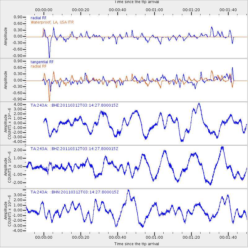
243A Waterproof, LA, USA - Earthquake Result Viewer
*The percent match for this event was below the threshold and hence no stack was calculated.
| Earthquake location: |
Near East Coast Of Honshu, Japan |
| Earthquake latitude/longitude: |
39.5/142.6 |
| Earthquake time(UTC): |
2011/03/12 (071) 03:01:47 GMT |
| Earthquake Depth: |
20 km |
| Earthquake Magnitude: |
5.8 MB |
| Earthquake Catalog/Contributor: |
WHDF/NEIC |
|
| Network: |
TA USArray Transportable Network (new EarthScope stations) |
| Station: |
243A Waterproof, LA, USA |
| Lat/Lon: |
31.88 N/91.48 W |
| Elevation: |
2.0 m |
|
| Distance: |
93.0 deg |
| Az: |
43.624 deg |
| Baz: |
321.17 deg |
| Ray Param: |
$rayparam |
*The percent match for this event was below the threshold and hence was not used in the summary stack. |
|
| Radial Match: |
22.615028 % |
| Radial Bump: |
357 |
| Transverse Match: |
42.454597 % |
| Transverse Bump: |
400 |
| SOD ConfigId: |
356183 |
| Insert Time: |
2011-08-19 12:29:42.949 +0000 |
| GWidth: |
2.5 |
| Max Bumps: |
400 |
| Tol: |
0.001 |
|
Signal To Noise
| Channel | StoN | STA | LTA |
| TA:243A: :BHZ:20110312T03:14:27.800015Z | 0.74642456 | 4.0878552E-7 | 5.476582E-7 |
| TA:243A: :BHN:20110312T03:14:27.800015Z | 1.9061213 | 1.2767388E-6 | 6.698098E-7 |
| TA:243A: :BHE:20110312T03:14:27.800015Z | 1.997077 | 2.0989885E-6 | 1.0510303E-6 |
| Arrivals |
| Ps | |
| PpPs | |
| PsPs/PpSs | |


