You are here: Home > Network List > TA - USArray Transportable Network (new EarthScope stations) Stations List
> Station BGNE Belgrade, NE, USA > Earthquake Result Viewer
BGNE Belgrade, NE, USA - Earthquake Result Viewer
*The percent match for this event was below the threshold and hence no stack was calculated.
| Earthquake location: |
Near East Coast Of Honshu, Japan |
| Earthquake latitude/longitude: |
36.0/141.3 |
| Earthquake time(UTC): |
2011/03/12 (071) 03:11:57 GMT |
| Earthquake Depth: |
17 km |
| Earthquake Magnitude: |
5.7 MB |
| Earthquake Catalog/Contributor: |
WHDF/NEIC |
|
| Network: |
TA USArray Transportable Network (new EarthScope stations) |
| Station: |
BGNE Belgrade, NE, USA |
| Lat/Lon: |
41.41 N/98.15 W |
| Elevation: |
573 m |
|
| Distance: |
85.7 deg |
| Az: |
40.537 deg |
| Baz: |
315.488 deg |
| Ray Param: |
$rayparam |
*The percent match for this event was below the threshold and hence was not used in the summary stack. |
|
| Radial Match: |
50.62661 % |
| Radial Bump: |
400 |
| Transverse Match: |
63.845844 % |
| Transverse Bump: |
400 |
| SOD ConfigId: |
356183 |
| Insert Time: |
2011-08-19 13:11:59.115 +0000 |
| GWidth: |
2.5 |
| Max Bumps: |
400 |
| Tol: |
0.001 |
|
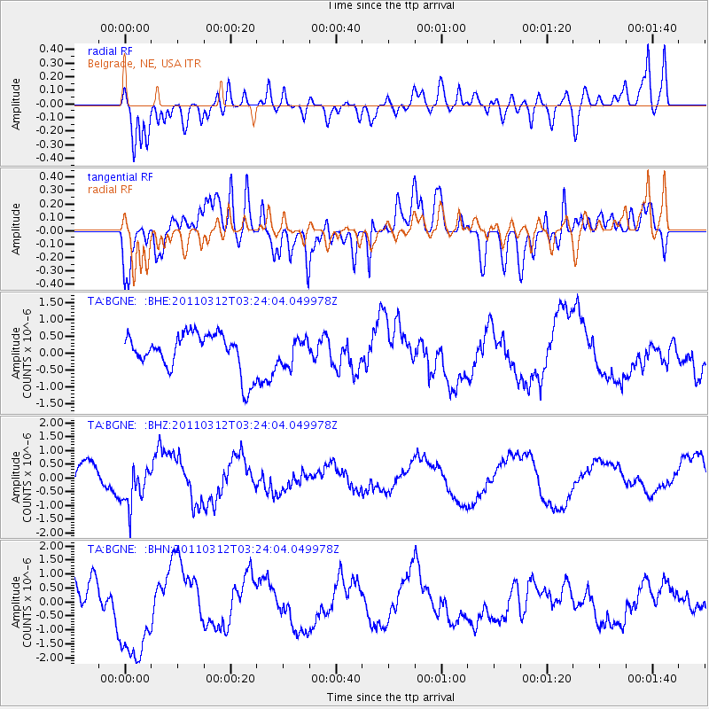
Signal To Noise
| Channel | StoN | STA | LTA |
| TA:BGNE: :BHZ:20110312T03:24:04.049978Z | 1.2685767 | 7.355481E-7 | 5.798215E-7 |
| TA:BGNE: :BHN:20110312T03:24:04.049978Z | 3.5387816 | 1.8666464E-6 | 5.2748277E-7 |
| TA:BGNE: :BHE:20110312T03:24:04.049978Z | 0.6793286 | 3.8227324E-7 | 5.627221E-7 |
| Arrivals |
| Ps | |
| PpPs | |
| PsPs/PpSs | |


