You are here: Home > Network List > TA - USArray Transportable Network (new EarthScope stations) Stations List
> Station M36A Felix, Anita, IA, USA > Earthquake Result Viewer
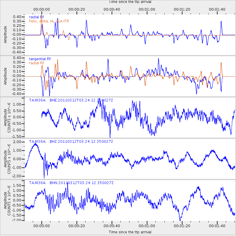
M36A Felix, Anita, IA, USA - Earthquake Result Viewer
*The percent match for this event was below the threshold and hence no stack was calculated.
| Earthquake location: |
Near East Coast Of Honshu, Japan |
| Earthquake latitude/longitude: |
36.0/141.3 |
| Earthquake time(UTC): |
2011/03/12 (071) 03:11:57 GMT |
| Earthquake Depth: |
17 km |
| Earthquake Magnitude: |
5.7 MB |
| Earthquake Catalog/Contributor: |
WHDF/NEIC |
|
| Network: |
TA USArray Transportable Network (new EarthScope stations) |
| Station: |
M36A Felix, Anita, IA, USA |
| Lat/Lon: |
41.45 N/94.80 W |
| Elevation: |
430 m |
|
| Distance: |
87.4 deg |
| Az: |
38.675 deg |
| Baz: |
317.583 deg |
| Ray Param: |
$rayparam |
*The percent match for this event was below the threshold and hence was not used in the summary stack. |
|
| Radial Match: |
67.15825 % |
| Radial Bump: |
400 |
| Transverse Match: |
66.537025 % |
| Transverse Bump: |
400 |
| SOD ConfigId: |
356183 |
| Insert Time: |
2011-08-19 13:40:23.899 +0000 |
| GWidth: |
2.5 |
| Max Bumps: |
400 |
| Tol: |
0.001 |
|
Signal To Noise
| Channel | StoN | STA | LTA |
| TA:M36A: :BHZ:20110312T03:24:12.350027Z | 1.261968 | 8.2426334E-7 | 6.5315703E-7 |
| TA:M36A: :BHN:20110312T03:24:12.350027Z | 2.8816087 | 8.6813685E-7 | 3.012681E-7 |
| TA:M36A: :BHE:20110312T03:24:12.350027Z | 2.1787226 | 9.5177904E-7 | 4.3685185E-7 |
| Arrivals |
| Ps | |
| PpPs | |
| PsPs/PpSs | |


