You are here: Home > Network List > KN - Kyrgyz Seismic Telemetry Network Stations List
> Station TKM2 KN.TKM2 > Earthquake Result Viewer
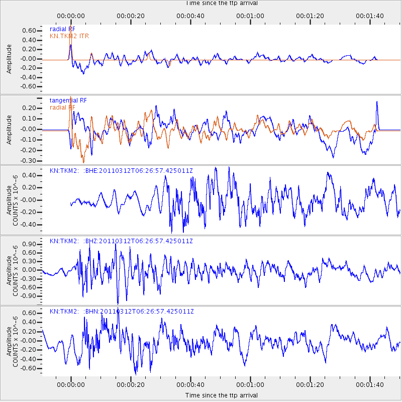
TKM2 KN.TKM2 - Earthquake Result Viewer
*The percent match for this event was below the threshold and hence no stack was calculated.
| Earthquake location: |
Near East Coast Of Honshu, Japan |
| Earthquake latitude/longitude: |
39.2/142.3 |
| Earthquake time(UTC): |
2011/03/12 (071) 06:18:44 GMT |
| Earthquake Depth: |
54 km |
| Earthquake Magnitude: |
5.5 MB |
| Earthquake Catalog/Contributor: |
WHDF/NEIC |
|
| Network: |
KN Kyrgyz Seismic Telemetry Network |
| Station: |
TKM2 KN.TKM2 |
| Lat/Lon: |
42.92 N/75.60 E |
| Elevation: |
2020 m |
|
| Distance: |
49.3 deg |
| Az: |
297.072 deg |
| Baz: |
70.437 deg |
| Ray Param: |
$rayparam |
*The percent match for this event was below the threshold and hence was not used in the summary stack. |
|
| Radial Match: |
56.939915 % |
| Radial Bump: |
400 |
| Transverse Match: |
39.69746 % |
| Transverse Bump: |
400 |
| SOD ConfigId: |
356183 |
| Insert Time: |
2011-08-19 14:53:54.330 +0000 |
| GWidth: |
2.5 |
| Max Bumps: |
400 |
| Tol: |
0.001 |
|
Signal To Noise
| Channel | StoN | STA | LTA |
| KN:TKM2: :BHZ:20110312T06:26:57.425011Z | 3.7106426 | 2.9981138E-7 | 8.07977E-8 |
| KN:TKM2: :BHN:20110312T06:26:57.425011Z | 2.0621145 | 2.9334782E-7 | 1.4225584E-7 |
| KN:TKM2: :BHE:20110312T06:26:57.425011Z | 2.6912222 | 2.4441678E-7 | 9.0819995E-8 |
| Arrivals |
| Ps | |
| PpPs | |
| PsPs/PpSs | |


