You are here: Home > Network List > TA - USArray Transportable Network (new EarthScope stations) Stations List
> Station Z39A Irene McRaven, Queen City, TX, USA > Earthquake Result Viewer
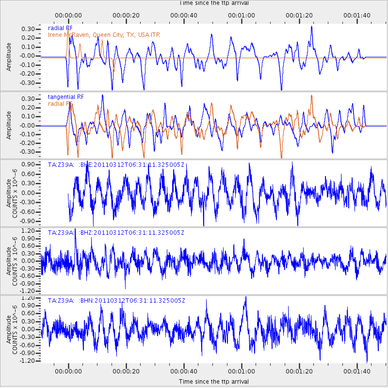
Z39A Irene McRaven, Queen City, TX, USA - Earthquake Result Viewer
*The percent match for this event was below the threshold and hence no stack was calculated.
| Earthquake location: |
Near East Coast Of Honshu, Japan |
| Earthquake latitude/longitude: |
39.2/142.3 |
| Earthquake time(UTC): |
2011/03/12 (071) 06:18:44 GMT |
| Earthquake Depth: |
54 km |
| Earthquake Magnitude: |
5.5 MB |
| Earthquake Catalog/Contributor: |
WHDF/NEIC |
|
| Network: |
TA USArray Transportable Network (new EarthScope stations) |
| Station: |
Z39A Irene McRaven, Queen City, TX, USA |
| Lat/Lon: |
33.24 N/94.18 W |
| Elevation: |
112 m |
|
| Distance: |
90.9 deg |
| Az: |
44.349 deg |
| Baz: |
319.58 deg |
| Ray Param: |
$rayparam |
*The percent match for this event was below the threshold and hence was not used in the summary stack. |
|
| Radial Match: |
52.43789 % |
| Radial Bump: |
400 |
| Transverse Match: |
46.992878 % |
| Transverse Bump: |
400 |
| SOD ConfigId: |
356183 |
| Insert Time: |
2011-08-19 15:28:59.107 +0000 |
| GWidth: |
2.5 |
| Max Bumps: |
400 |
| Tol: |
0.001 |
|
Signal To Noise
| Channel | StoN | STA | LTA |
| TA:Z39A: :BHZ:20110312T06:31:11.325005Z | 1.6331629 | 3.8965905E-7 | 2.3859167E-7 |
| TA:Z39A: :BHN:20110312T06:31:11.325005Z | 0.76096356 | 1.8527024E-7 | 2.4346795E-7 |
| TA:Z39A: :BHE:20110312T06:31:11.325005Z | 0.983662 | 3.7922837E-7 | 3.855271E-7 |
| Arrivals |
| Ps | |
| PpPs | |
| PsPs/PpSs | |


