You are here: Home > Network List > TA - USArray Transportable Network (new EarthScope stations) Stations List
> Station E31A Nome, ND, USA > Earthquake Result Viewer
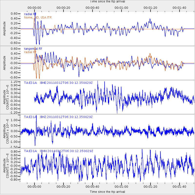
E31A Nome, ND, USA - Earthquake Result Viewer
*The percent match for this event was below the threshold and hence no stack was calculated.
| Earthquake location: |
Near East Coast Of Honshu, Japan |
| Earthquake latitude/longitude: |
39.2/142.3 |
| Earthquake time(UTC): |
2011/03/12 (071) 06:18:44 GMT |
| Earthquake Depth: |
54 km |
| Earthquake Magnitude: |
5.5 MB |
| Earthquake Catalog/Contributor: |
WHDF/NEIC |
|
| Network: |
TA USArray Transportable Network (new EarthScope stations) |
| Station: |
E31A Nome, ND, USA |
| Lat/Lon: |
46.56 N/97.89 W |
| Elevation: |
427 m |
|
| Distance: |
79.1 deg |
| Az: |
37.581 deg |
| Baz: |
316.604 deg |
| Ray Param: |
$rayparam |
*The percent match for this event was below the threshold and hence was not used in the summary stack. |
|
| Radial Match: |
59.490135 % |
| Radial Bump: |
400 |
| Transverse Match: |
64.22419 % |
| Transverse Bump: |
400 |
| SOD ConfigId: |
356183 |
| Insert Time: |
2011-08-19 15:36:46.439 +0000 |
| GWidth: |
2.5 |
| Max Bumps: |
400 |
| Tol: |
0.001 |
|
Signal To Noise
| Channel | StoN | STA | LTA |
| TA:E31A: :BHZ:20110312T06:30:12.350029Z | 2.9280276 | 4.8586554E-7 | 1.6593611E-7 |
| TA:E31A: :BHN:20110312T06:30:12.350029Z | 1.6590283 | 3.6115483E-7 | 2.1769057E-7 |
| TA:E31A: :BHE:20110312T06:30:12.350029Z | 1.6816614 | 4.343665E-7 | 2.5829607E-7 |
| Arrivals |
| Ps | |
| PpPs | |
| PsPs/PpSs | |


