You are here: Home > Network List > TA - USArray Transportable Network (new EarthScope stations) Stations List
> Station E33A Westby DABS, Erhard, MN, USA > Earthquake Result Viewer
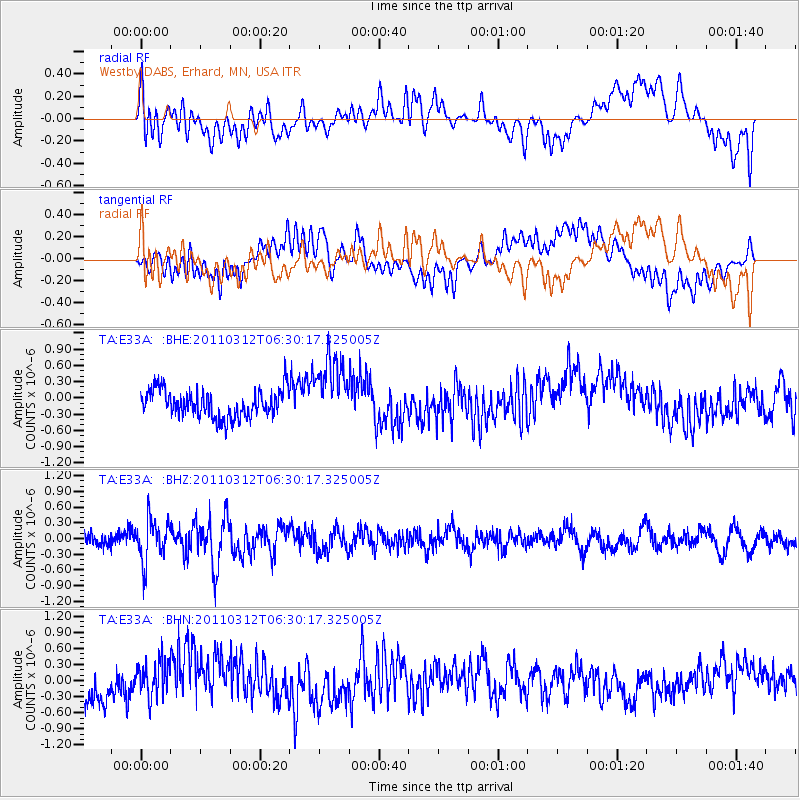
E33A Westby DABS, Erhard, MN, USA - Earthquake Result Viewer
*The percent match for this event was below the threshold and hence no stack was calculated.
| Earthquake location: |
Near East Coast Of Honshu, Japan |
| Earthquake latitude/longitude: |
39.2/142.3 |
| Earthquake time(UTC): |
2011/03/12 (071) 06:18:44 GMT |
| Earthquake Depth: |
54 km |
| Earthquake Magnitude: |
5.5 MB |
| Earthquake Catalog/Contributor: |
WHDF/NEIC |
|
| Network: |
TA USArray Transportable Network (new EarthScope stations) |
| Station: |
E33A Westby DABS, Erhard, MN, USA |
| Lat/Lon: |
46.50 N/96.01 W |
| Elevation: |
428 m |
|
| Distance: |
80.0 deg |
| Az: |
36.649 deg |
| Baz: |
317.798 deg |
| Ray Param: |
$rayparam |
*The percent match for this event was below the threshold and hence was not used in the summary stack. |
|
| Radial Match: |
68.217125 % |
| Radial Bump: |
400 |
| Transverse Match: |
58.603134 % |
| Transverse Bump: |
400 |
| SOD ConfigId: |
356183 |
| Insert Time: |
2011-08-19 15:37:00.588 +0000 |
| GWidth: |
2.5 |
| Max Bumps: |
400 |
| Tol: |
0.001 |
|
Signal To Noise
| Channel | StoN | STA | LTA |
| TA:E33A: :BHZ:20110312T06:30:17.325005Z | 2.0912611 | 3.9024337E-7 | 1.8660671E-7 |
| TA:E33A: :BHN:20110312T06:30:17.325005Z | 1.5211605 | 3.7793347E-7 | 2.4845076E-7 |
| TA:E33A: :BHE:20110312T06:30:17.325005Z | 2.4840403 | 6.255627E-7 | 2.5183274E-7 |
| Arrivals |
| Ps | |
| PpPs | |
| PsPs/PpSs | |


