You are here: Home > Network List > US - United States National Seismic Network Stations List
> Station WMOK Wichita Mountains, Oklahoma, USA > Earthquake Result Viewer
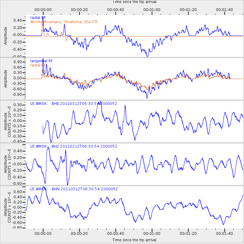
WMOK Wichita Mountains, Oklahoma, USA - Earthquake Result Viewer
*The percent match for this event was below the threshold and hence no stack was calculated.
| Earthquake location: |
Near East Coast Of Honshu, Japan |
| Earthquake latitude/longitude: |
39.2/142.3 |
| Earthquake time(UTC): |
2011/03/12 (071) 06:18:44 GMT |
| Earthquake Depth: |
54 km |
| Earthquake Magnitude: |
5.5 MB |
| Earthquake Catalog/Contributor: |
WHDF/NEIC |
|
| Network: |
US United States National Seismic Network |
| Station: |
WMOK Wichita Mountains, Oklahoma, USA |
| Lat/Lon: |
34.74 N/98.78 W |
| Elevation: |
486 m |
|
| Distance: |
87.3 deg |
| Az: |
46.21 deg |
| Baz: |
317.049 deg |
| Ray Param: |
$rayparam |
*The percent match for this event was below the threshold and hence was not used in the summary stack. |
|
| Radial Match: |
39.41946 % |
| Radial Bump: |
400 |
| Transverse Match: |
38.1372 % |
| Transverse Bump: |
400 |
| SOD ConfigId: |
356183 |
| Insert Time: |
2011-08-19 15:49:58.104 +0000 |
| GWidth: |
2.5 |
| Max Bumps: |
400 |
| Tol: |
0.001 |
|
Signal To Noise
| Channel | StoN | STA | LTA |
| US:WMOK: :BHZ:20110312T06:30:54.200005Z | 2.2167084 | 3.6311758E-7 | 1.6380936E-7 |
| US:WMOK: :BHN:20110312T06:30:54.200005Z | 2.3741117 | 8.153862E-7 | 3.43449E-7 |
| US:WMOK: :BHE:20110312T06:30:54.200005Z | 2.2151072 | 3.1967352E-7 | 1.4431515E-7 |
| Arrivals |
| Ps | |
| PpPs | |
| PsPs/PpSs | |


