You are here: Home > Network List > CN - Canadian National Seismograph Network Stations List
> Station FRB Iqaluit, Nunavut Territory, Canada > Earthquake Result Viewer
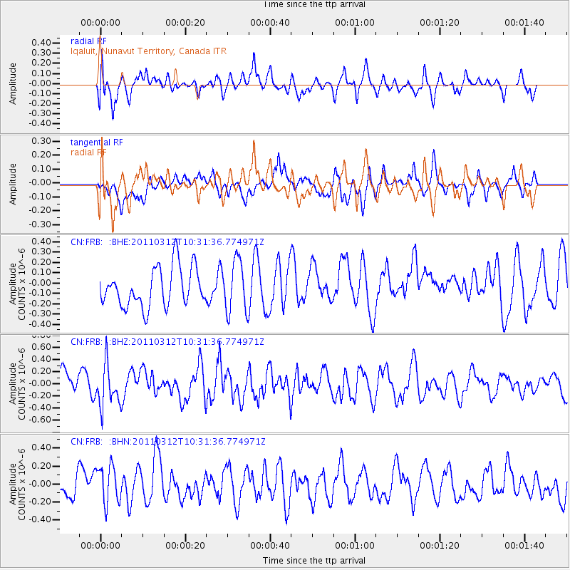
FRB Iqaluit, Nunavut Territory, Canada - Earthquake Result Viewer
*The percent match for this event was below the threshold and hence no stack was calculated.
| Earthquake location: |
Off East Coast Of Honshu, Japan |
| Earthquake latitude/longitude: |
37.2/143.5 |
| Earthquake time(UTC): |
2011/03/12 (071) 10:20:21 GMT |
| Earthquake Depth: |
22 km |
| Earthquake Magnitude: |
5.5 MB, 5.3 MW |
| Earthquake Catalog/Contributor: |
WHDF/NEIC |
|
| Network: |
CN Canadian National Seismograph Network |
| Station: |
FRB Iqaluit, Nunavut Territory, Canada |
| Lat/Lon: |
63.75 N/68.55 W |
| Elevation: |
25 m |
|
| Distance: |
76.3 deg |
| Az: |
14.046 deg |
| Baz: |
334.15 deg |
| Ray Param: |
$rayparam |
*The percent match for this event was below the threshold and hence was not used in the summary stack. |
|
| Radial Match: |
54.029976 % |
| Radial Bump: |
400 |
| Transverse Match: |
43.444424 % |
| Transverse Bump: |
400 |
| SOD ConfigId: |
356183 |
| Insert Time: |
2011-08-19 16:43:51.106 +0000 |
| GWidth: |
2.5 |
| Max Bumps: |
400 |
| Tol: |
0.001 |
|
Signal To Noise
| Channel | StoN | STA | LTA |
| CN:FRB: :BHZ:20110312T10:31:36.774971Z | 1.9402052 | 3.4357453E-7 | 1.7708153E-7 |
| CN:FRB: :BHN:20110312T10:31:36.774971Z | 1.0108831 | 2.234176E-7 | 2.210123E-7 |
| CN:FRB: :BHE:20110312T10:31:36.774971Z | 1.3466274 | 2.5405384E-7 | 1.8865936E-7 |
| Arrivals |
| Ps | |
| PpPs | |
| PsPs/PpSs | |


